
Mountain range Akaishi Mountains | Elevation 2,685 m Parent range Akaishi Mountains | |
 | ||
Translation (wood)saw mountain (Japanese) Topo map Geographical Survey Institute 25000:1 甲斐駒ヶ岳50000:1 甲府 Similar Mount Kaikoma, Mount Senjō, Mt Ashitaka, Mount Kisokoma, Echizendakeashitakayama | ||
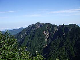
Mount Nokogiri (鋸岳, Nokogiri-dake) is a mountain located in the Akaishi Mountains on the border between, Yamanashi and Nagano Prefectures in Japan.
Contents
- Map of Mt Nokogiri Hakushucho Shirasu Hokuto Yamanashi Prefecture 408 0315 Japan
- Outline
- Nearby Mountains
- River of source
- References
Map of Mt. Nokogiri, Hakushucho Shirasu, Hokuto, Yamanashi Prefecture 408-0315, Japan
Outline
This area is in Minami Alps National Park that was established on June 1, 1964. This mountain is also one of the "200 Famous Japanese Mountains". There is no general mountain climbing trail. Therefore, it is difficult to climb it. There is the shelter Mountain hut ("6th Stone-Hut") between this mountain and Mount Kaikoma. The original hut was rebuilt in 2006.
Nearby Mountains
It is on the main ridge line in the northern edge of the Akaishi Mountains.
River of source
Mount Nokogiri is the source of the Fuji River. The Rivers of the source flow to the Pacific Ocean.
References
Mount Nokogiri (Akaishi) Wikipedia(Text) CC BY-SA