
Elevation 1,275 m | ||
 | ||
Similar Mount Jukes, Mount Sedgwick, Mount Huxley, Mount Heemskirk, Castle Crag | ||
Mount Murchison is a mountain on the West Coast Range located in the West Coast region of Tasmania, Australia.
At 1,275 metres (4,183 ft) above sea level, it is the highest mountain in the range and within the top thirty highest mountains in Tasmania.
Location and features
Lying close to the Williamsford and Tullah mining areas, the mountain is often found referred to in early photographs. It lies east of Zeehan, and Mount Read, and north of Mount Tyndall. The track to the summit takes approximately six hours to complete.
From the trig point the nearby Towns of Tullah, Rosebery and Zeehan can be seen on a clear day. Mount Murchison is for moderately experienced climbers and contains sections that includes loose and sometimes slippery rock.
The geology of the ground around the mountain relates to the range of mining activities nearby.
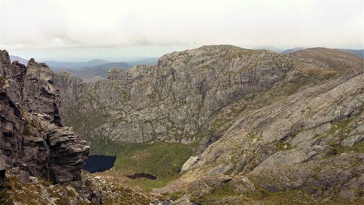
On the south eastern side there a number of lakes, some unnamed. From the north, they are Shaded Lake, Little Sister, Lake Gaye and Lake Sandra lying to the east of the southernmost part of the main mountain, and below a very steep cliff.
It was named by Charles Gould in the early 1860s.