
Population 273 (2011 census) Mount Molloy Mona Mona | Postcode(s) 4871 Postal code 4871 | |
 | ||
Location 1,756 km (1,091 mi) NW of Brisbane101 km (63 mi) NW of Cairns40 km (25 mi) N of Mareeba44 km (27 mi) SW of Port Douglas Weather 27°C, Wind NE at 14 km/h, 73% Humidity | ||
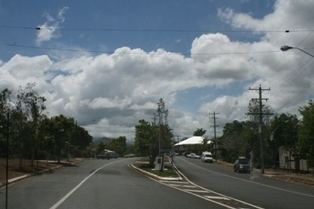
Mount Molloy is a historic mining and timber town and locality lying 55 kilometres (34 mi) north of Cairns in Queensland, Australia. It is within the local government area of Shire of Mareeba (between 2008 and 2013, it was within the Tablelands Region). At the 2011 census, the town and surrounding area had a population of 273.
Contents
History
At its height Mount Molloy was a copper mine in the 1890s. It was commonly used as camping grounds and Chinese market gardeners used to grow grain and other foodstuffs for the miners nearby.
A private railway was constructed to Mount Molloy, junctioning from the Cairns to Mareeba line at Biboohra, opening in August 1908. It was built by Mount Molloy Limited to serve its smelters. The line was transferred to Queensland Railways on 1 March 1917 following the liquidation of the company and was extended to Rumula on 5 December 1926. The branch closed on 1 May 1964.
Molloy Post Office opened by July 1905 and was renamed Mount Molloy in 1982.
Mount Molloy was named after Patrick Molloy, an early teamster for a stock route and the person who discovered copper at what was to become Mount Molloy.
Today the dominant industry of Mount Molloy is now cattle grazing and consists of a few shops and an old hotel.
Geography
Nearby towns are Julatten, Mount Carbine and Mount Mulligan. Quaid Road terminates south of Mount Molloy. A majority of the eastern half of Mount Molloy is protected within Kuranda National Park. Mount Molloy lies within both the Mitchell River and Barron River water catchment areas.
Heritage listings
Mount Molloy has a number of heritage-listed sites, including: