
Elevation 10,300+ ft (3,139+ m) Prominence 2,263 m | Topo map USGS Mount Hayes A-2 | |
 | ||
Listing North America prominent peak 56th Location Southeast Fairbanks Census Area, Alaska, U.S. First ascent June 13, 1969 by Tom Kensler, Mike Sallee, Dan Osborne, Grace Hoeman Easiest route Southwest Ridge: glacier/snow/ice/rock climb (Alaska Grade 2+) Mountain range Alaska Range, Delta Mountains Parent ranges Delta Mountains, Alaska Range Similar Mount Crillon, Mount Isto, Mount Igikpak, Mount Marcus Baker, Mount Griggs | ||
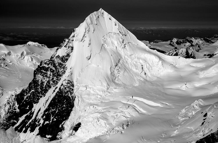
Mount Kimball is the highest mountain in the section of the eastern Alaska Range between Isabel Pass (traversed by the Richardson Highway) and Mentasta Pass (traversed by the Glenn Highway), about 30 miles from Paxson. It is one of the twenty most topographically prominent peaks in Alaska.
Map of Mt Kimball, Alaska, USA
Mount Kimball is a relatively difficult climb for a peak with low absolute elevation, due to difficult ridge terrain, and it rebuffed eight climbing attempts by experienced Alaskan mountaineers before its first ascent in 1969. Due to its remoteness, difficulty, and low stature compared to other major Alaskan summits, the peak is not often climbed.
References
Mount Kimball (Alaska) Wikipedia(Text) CC BY-SA