
Country United States Elevation 113 m Zip code 17552 Area code Area codes 717 and 223 | Time zone EST (UTC-5) Area 6 km² Population 7,909 (2013) Local time Sunday 10:01 PM | |
 | ||
Weather 4°C, Wind NW at 13 km/h, 79% Humidity | ||
Mount Joy is a borough in Lancaster County, Pennsylvania, United States. The population was 7,410 at the 2010 census.
Contents
- Map of Mount Joy PA 17552 USA
- Name and origin
- General information
- Geography
- Demographics
- Museums and historic sites
- Notable people
- References
Map of Mount Joy, PA 17552, USA
Name and origin
Mount Joy is often named in lists of "delightfully-named towns" in Pennsylvania Dutch Country, along with Intercourse, Blue Ball, Lititz, Bareville, Bird-in-Hand and Paradise.
The name is often shortened to Mt Joy, as in Mencken (1963). However, citizens of the town often point out that this abbreviation is not proper because the town is not named for a mountain but is named after the Good Ship "Mountjoy" which famously broke a Catholic siege during the Siege of Derry. Due to the early settlement of the Protestant Scots-Irish in this region of Pennsylvania, many of the municipalities in the area were given names common to the North of Ireland such as: Derry Township, Londonderry Township, South Londonderry Township, Mount Joy Township, East Donegal Township, West Donegal Township, and Rapho Township.
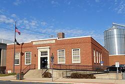
General information
Geography
Mount Joy is located at 40°6′36″N 76°30′40″W (40.109895, -76.510977).
According to the United States Census Bureau, the borough has a total area of 2.3 square miles (6.1 km²), all of it land. It is considered to be part of the Susquenanna Valley.
Demographics
The 2010 United States Census reports the following demographics for Mount Joy Borough: