
- elevation 997 ft (304 m) - elevation 522 ft (159 m) | - Visitor Center The Notch Phone +1 413-253-2883 | |
 | ||
Management Department of Conservation and Recreation Similar J A Skinner State Park, Mount Tom State Reservation, Mount Sugarloaf State Res, Chicopee Memorial State Park, Connecticut River Greenwa | ||
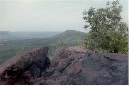
Mount Holyoke Range State Park is a state-owned, public recreation area encompassing the eastern half of the Holyoke Range in the Pioneer Valley region of Massachusetts. The state park is adjacent to J. A. Skinner State Park, which occupies the western half of the Holyoke Range. Both are managed by the Massachusetts Department of Conservation and Recreation.
Contents
HistoryEdit
"No single event, such as a land acquisition, dedication ceremony, or Act of the Legislature signaled [Mount Holyoke Range State Park's] establishment. Rather, creation of the park built upon a long-standing desire by the public and the Commonwealth to protect the range. The DCR’s predecessor agencies had been acquiring land in the region since the acquisition of Skinner state park in 1940.... However, the focused acquisition of land in fee or easements that began in 1975 marked a turning point for land protection on the range."
Resource Management Plan: Mount Holyoke Range Planning Unit, Department of Conservation and Recreation, July 2013, p. 16
Activities and amenitiesEdit
Park trails are used for hiking, horseback riding, and cross-country skiing. Trails include sections of the long-distance Metacomet-Monadnock and Robert Frost trails. A visitors center is located near "The Notch" on Route 116 in Amherst. Picnicking and restricted hunting are also offered.