
Elevation 143 m | ||
 | ||
Location North Island, New Zealand Volcanic arc/belt Auckland volcanic field Address 175 Remuera Rd, Remuera West, Auckland 1050, New Zealand Similar Maungarei, Maungawhau, Mount Victoria, Te Tatua‑a‑Riukiuta, Mangere Mountain | ||
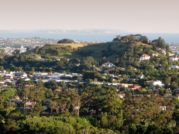
Ōhinerau / Mount Hobson (also known as Ōhinerangi and Remuwera) is a 143 m high volcanic cone in the Auckland volcanic field in Auckland, New Zealand.
Located in the Remuera suburb, to the east of the Newmarket commercial suburb, it has been extensively modified by human use, first by Māori for use as a pā and later by use as quarry and pasture land before finally having a water reservoir installed in its cone to supply the surrounding area. An additional, partially buried, water reservoir was built on the low southern side of the mountain in 1955. English oaks and pōhutukawa are the most common trees on the hill.
Ōhinerau is named after Hinerau, a goddess of whirlwinds. Mount Hobson is named after Captain William Hobson. Remuwera was originally the name of a pa site on the hill that was also utilised for kumara and food gardens. The name Remuwera means the burnt edge of a flax garment.
In the 2014 Treaty of Waitangi settlement with the Tamaki Makaurau Collective of 13 Auckland iwi, the volcano was officially named Ōhinerau / Mount Hobson and ownership was vested to the collective. It is now co-governed by the collective and Auckland Council in common benefit of the iwi "and all other people of Auckland".