
Listing Ultra Easiest route Northwest Ridge First ascent 28 October 1932 | Elevation 7,556 m Prominence 3,642 m Mountain range Daxue Mountains | |
 | ||
Isolation 661 kilometres (411 mi) Similar Mount Siguniang, Xueshan, Namcha Barwa, Mount Emei, Bogda Peak | ||
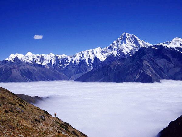
Mount Gongga (simplified Chinese: 贡嘎山; traditional Chinese: 貢嘎山; pinyin: Gònggá Shān), also known as Minya Konka (Khams Tibetan pinyin: Mi'nyâg Gong'ga Riwo), is the highest mountain in Sichuan province, China. It is also known to locals as "The King of Sichuan Mountains". Situated in the Daxue Shan mountain range, between Dadu River and Yalong River, part of the Hengduan mountainous region, Mount Gongga is the easternmost 7,000 metres (23,000 ft) peak in the world and the third highest peak outside of the Himalaya/Karakoram, after Tirich Mir and Kongur Tagh.
Map of Mount Gongga, Luding, Garze, China
The peak has large vertical relief over the deep nearby gorges.
According to an early remote measurement of the mountain, then called Bokunka, was performed by the expedition of Graf Béla Széchenyi 1877-80. They came to a height of 7600 meter. 45 years later the mountain, this time called Gang ka, was sketched by missionary J. H. Edgar, again from remote.
In 1930 ( puts the date at 1929) the explorer Joseph Rock, making an attempt to measure its altitude, mis-calculated its height as 30,250 ft (9,220 m) and cabled the National Geographic Society to announce Minya Konka as the highest mountain in the world. This measurement was viewed with suspicion from the start, and the Society's decision to check Rock's calculations before publication was well-founded. Following discussions with the Society, Rock reduced the claim to 7,803 m (25,600 ft) in his formal publication. In 1930 Swiss geographer Eduard Imhof measured 7,590 m (24,900 ft).
A second, better-equipped American team returned in 1932, and did an accurate survey of the peak and its environs. Their summit altitude measurement agreed with Imhof's figure of 7,590 m. Two members (Terris Moore, and Richard Burdsall) of this small expedition (only four climbing members, including Arthur B. Emmons and Jack T. Young) succeeded in climbing to the summit. They began on the west side of the mountain and climbed the Northwest Ridge.
This was a remarkable achievement at the time, considering the height of the mountain, its remoteness, and the small size of the group. In addition, this peak was the highest summit reached by Americans until 1958 (though Americans had by that time climbed to higher non-summit points). The book written by the expedition members, "Men Against The Clouds" remains a mountaineering classic.
The Himalayan Index lists five additional ascents of Gongga Shan, and seven unsuccessful attempts. A number of deaths have occurred on Gongga Shan, which earned a reputation as a difficult and dangerous mountain. In 1981, eight Japanese climbers died of a fall during an unsuccessful attempt. Until 1999, more climbers had died trying to climb the mountain than had reached the summit.
The SummitPost reports that until 2003 the mountain was successfully climbed only eight times. In total 22 climbers reached the summit. In total 16 climbers died.