
Topo map USGS Mount Eddy Prominence 1,571 m | Elevation 2,751 m | |
 | ||
Similar Thompson Peak, Mount Shasta, White Mountain Peak, Russian Peak, Preston Peak | ||
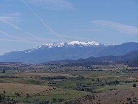
Mount Eddy is the highest peak of the Trinity Mountains, a mountain range of the Klamath Mountains System, located in Siskiyou County, and Trinity County in northern California.
Contents
Map of Mt Eddy, California 96067, USA
The mountain is in the Mount Eddy RNA, a Research Natural Area on the Shasta-Trinity National Forest, a unit of the United States Forest Service.
GeographyEdit
The summit rises to an elevation of 9,037 feet (2,754 m), and is the highest point in Trinity County, the ninth most prominent peak in California, and the highest summit west of Interstate 5 in the United States.
The peak is west of Mount Shasta City and the massive Mount Shasta volcano. It is protected within the Shasta-Trinity National Forest.
The mountain receives heavy snowfall during the winter due to its altitude.
The mountain is named in honor of Olive Paddock Eddy, the first woman to climb Mt. Shasta. She and her husband, Nelson Harvey Eddy, arrived in the area from New York State in 1856. He later became a successful rancher in the Shasta Valley. The original, Wintu, name might have been Num-mel-be-le-sas-pam or "west blaze mountain".