
Elevation 546 m | Mountain range Darling Scarp | |
 | ||
Similar Mount Cooke, Toolbrunup, Mount St Gwinear, Mount Donna Buang, Mount Manypeaks | ||
Mount dale wild adv first gopro
Mount Dale is a mountain in Western Australia about 25 km east of Armadale in the Shire of Beverley. At 546 m high, it is one of the highest points in the Darling Scarp.
Contents
Map of Mount Dale, Flint WA 6302, Australia
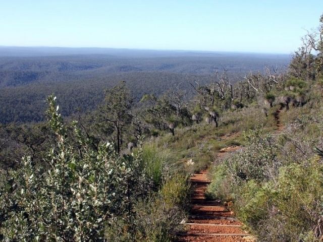
It is best known for its walk track, which forms part of the Bibbulmun Track. The track leads from a parking and picnic area to the summit, passing through 500 metres of jarrah forest, which is coloured by a host of wildflowers in spring. South of Mundaring Weir, Mount Dale is visible when looking SSE from Glen Forrest outside Helena College on Bilgoman Road.
Mount Dale was once the site of a fire lookout tower as it provides almost uninterrupted 360° views over the National Park and surrounding State Forest areas.
This has now been replaced by a communications tower which obstructs the 360° panorama, though the footings of the old lookout tower and associated equipment are still visible among the undergrowth and stunning panoramic views are available from the parking area just below the peak. It was named after Ensign (later Lieutenant) Robert Dale, who in 1829 became the first European explorer to venture into the Darling Scarp.