
Prominence 87 m | Elevation 2,026 m Easiest route Hiking | |
 | ||
Similar Balsam Cone, Celo Knob, Mount Mitchell, Mount Guyot, Clingmans Dome | ||
Mount Craig, 6,647 feet (2,026 m), is the second highest peak of the Appalachian Mountains and second only to 6,684 feet (2,037 m) Mount Mitchell in eastern North America. It is located in the Black Mountains in Yancey County, North Carolina. The mountain lies just north of Mt. Mitchell and is within Mount Mitchell State Park and the Pisgah National Forest.
Contents
Map of Mt Craig, Pensacola, NC 28714, USA
Mount Craig was named in honor of Locke Craig, the governor of North Carolina from 1913 to 1917 responsible for establishing Mount Mitchell State Park in 1915 as the state's first, thereby protecting the area from excessive logging.
Trails
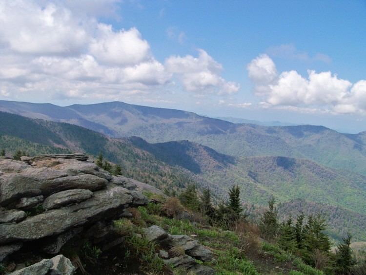
The mountain can easily be reached via an approximately 45-minute hike on the Deep Gap Trail from the picnic area below the summit of Mount Mitchell off North Carolina State Highway 128. The view atop Mount Craig embraces much of the southern portion of the Black Mountain Range. A North Carolina Geodetic Survey triangulation marker is located on the summit.
The Deep Gap Trail proceeds beyond Mount Craig to other North Carolina high peaks including Big Tom, Cattail Peak, Balsam Cone, Potato Hill and through Deep Gap to Winter Star Mountain, Gibbs Mountain and Celo Knob.
Elevation designation
Formerly the third highest point in eastern North America, Mount Craig is currently designated by the USGS as the second. However, there is only a 4 foot (1.3 m) difference in elevation between it and 6,643' (2,025 m) Clingman's Dome, the highest point in the Great Smoky Mountains. Clingmans Dome's elevation is based on a conventional 1920 optical survey. Mount Craig's elevation was revised upwards in 1993 based upon satellite GPS to an accuracy of 4 inches (10 centimeters). Until Clingman's Dome can be remeasured by GPS Mt. Craig retains its designation as second highest.