
Postcode(s) 5418 Postal code 5418 | Mount Bryan Mount Bryan EastBurra Local time Monday 8:04 AM | |
 | ||
Population 355 (shared with other localities within the “State Suburb of Booborowie”) (2011 census) Location 128 km (80 mi) north of Adelaide70 km (43 mi) south of Peterborough16 km (10 mi) north of Burra Weather 20°C, Wind E at 8 km/h, 57% Humidity | ||
Mount Bryan is a town in north-east South Australia. The town is situated on the Barrier Highway and former Peterborough railway line, 20 kilometres (12 mi) north of Burra, in the Regional Council of Goyder. At the 2006 census, Mount Bryan had a population of 137.
Map of Mount Bryan SA 5418, Australia
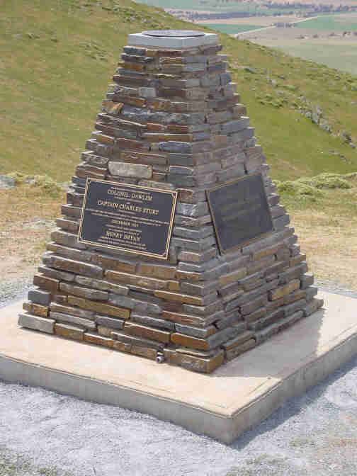
The town was named after a nearby peak, Mount Bryan, which was discovered in December 1839 by Governor George Gawler and who named it in honour of Henry Bryan, a young man who became lost and perished of thirst during Gawler's expedition. Among those accompanying Gawler were Charles Sturt and Henry Inman.
Once the heart of a thriving farming community, including some of Australia's best known Merino sheep studs, the town today is largely represented by the Mount Bryan Hotel—an old pub.
At the northern end of the Mount Lofty Ranges, the views of and from the surrounding hills are scenic. A popular route is north east to Sir Hubert Wilkins cottage, the restored home in which the polar explorer was born and grew up.
The addition of Hallett Wind Farm in the late 2000s and early 2010s has seen wind generating energy from some of the ridge-tops north of Mount Bryan.
The historic Mackerode Homestead is listed on the South Australian Heritage Register.