
Easiest route Moderate scramble Prominence 1,149 m Mountain range Flathead Range | Topo map NTS 82G/01 Elevation 2,910 m Province Alberta Parent range Flathead Range | |
 | ||
Similar Mount Galwey, Mount Galatea, Mount Haig, Mount Richardson, Mount Aylmer | ||
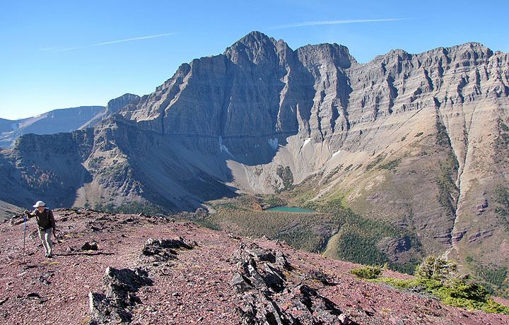
Mount blakiston trip in waterton np
Mount Blakiston is a mountain in the southwestern corner of Alberta, Canada and the highest point within Waterton Lakes National Park. The mountain is situated in the Clark Range, north of Lineham Creek and south of Blakiston Creek. The Lineham Creek hiking trail passes along the foot of the southern slopes of the mountain and for capable scramblers, Blakiston's rubbly but steep southern slopes provide a suitable line of ascent.
Contents
- Mount blakiston trip in waterton np
- Map of Mount Blakiston Improvement District No 4 AB Canada
- Mount blakiston july 30 2011 mp4
- References
Map of Mount Blakiston, Improvement District No. 4, AB, Canada
Blakiston's closest neighbours include Mount Hawkins 2,685 m (8,809 ft) directly to the west along a connecting ridge and Mount Lineham 2,728 m (8,950 ft) to the south.
The mountain was named in 1858 for Thomas Blakiston, a member of the Palliser Expedition.
Mount blakiston july 30 2011 mp4
References
Mount Blakiston Wikipedia(Text) CC BY-SA