
Country United States County McPherson Incorporated 1887 Elevation 455 m Zip code 67107 Local time Sunday 2:43 PM | Time zone CST (UTC-6) Area 3.65 km² Population 1,753 (2013) Area code 620 | |
 | ||
Weather 30°C, Wind S at 43 km/h, 35% Humidity | ||
Moundridge is a city in McPherson County, Kansas, United States. As of the 2010 census, the city population was 1,737. The city is named for the settlement that became the incorporated city in 1887 located in Mound Township.
Contents
- Map of Moundridge KS 67107 USA
- Early history
- 19th century
- Language
- Geography
- 2010 census
- 2000 census
- Primary and secondary education
- Transportation
- Utilities
- Notable people
- References
Map of Moundridge, KS 67107, USA
Early history
For many millennia, the Great Plains of North America was inhabited by nomadic Native Americans. From the 16th century to 18th century, the Kingdom of France claimed ownership of large parts of North America. In 1762, after the French and Indian War, France secretly ceded New France to Spain, per the Treaty of Fontainebleau.
19th century
In 1802, Spain returned most of the land to France. In 1803, most of the land for modern day Kansas was acquired by the United States from France as part of the 828,000 square mile Louisiana Purchase for 2.83 cents per acre.
In 1854, the Kansas Territory was organized, then in 1861 Kansas became the 34th U.S. state. In 1867, McPherson County was established within the Kansas Territory, which included the land for modern day Moundridge.
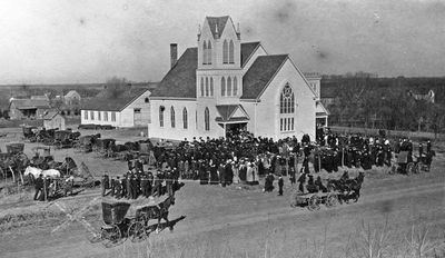
In 1876, the community was founded with the name Christian. In 1887, it was renamed Moundridge after the elevation of the town site.
The Moundridge area was settled by Mennonites soon after the completion of the transcontinental railroad in 1869. The museums in nearby Hillsboro and Goessel demonstrate the lives and times of these early settlers.
Between 1874 and 1880, of the approximately 45,000 Mennonites who had been living in South Russia, 10,000 departed for the United States and 8,000 for Manitoba. Available cropland in the central United States was similar to that in their homelands in the Crimean Peninsula. Since the central part of the state was settled, Kansas has enjoyed the reputation as the top wheat-producing state. Settlers in central Kansas, experienced in Russian methods of dryland farming and flour milling, introduced winter wheat in 1873 and quickly saw their industry become dominant.
Language
Virtually all of the original settlers of McPherson County spoke German, many exclusively. With the coming of the automobile and the importance of commercial participation with the English-speaking citizens, the use of German diminished in importance. The participation of the United States in World War I and II dramatically increased the use of English and by the early 1940s, ministers rarely preached in German. As of the year 2000, a very small number of German religious publications are available, primarily for use by elderly congregants.
Geography
Moundridge is located at 38°12′9″N 97°31′7″W (38.202497, -97.518506). According to the United States Census Bureau, the city has a total area of 1.41 square miles (3.65 km2), all of it land.
2010 census
As of the census of 2010, there were 1,737 people, 736 households, and 461 families residing in the city. The population density was 1,231.9 inhabitants per square mile (475.6/km2). There were 803 housing units at an average density of 569.5 per square mile (219.9/km2). The racial makeup of the city was 96.9% White, 0.3% African American, 0.4% Native American, 0.1% Asian, 0.9% from other races, and 1.3% from two or more races. Hispanic or Latino of any race were 3.4% of the population.
There were 736 households of which 25.7% had children under the age of 18 living with them, 49.7% were married couples living together, 8.8% had a female householder with no husband present, 4.1% had a male householder with no wife present, and 37.4% were non-families. 33.6% of all households were made up of individuals and 19.4% had someone living alone who was 65 years of age or older. The average household size was 2.25 and the average family size was 2.85.
The median age in the city was 46.6 years. 21.6% of residents were under the age of 18; 6% were between the ages of 18 and 24; 20% were from 25 to 44; 24.9% were from 45 to 64; and 27.6% were 65 years of age or older. The gender makeup of the city was 46.1% male and 53.9% female.
2000 census
As of the census of 2000, there were 1,593 people, 647 households, and 419 families residing in the city. The population density was 1,519.6 people per square mile (585.8/km²). There were 681 housing units at an average density of 649.6 per square mile (250.4/km²). The racial makeup of the city was 97.24% White, 0.50% African American, 0.88% Native American, 0.06% Asian, 0.75% from other races, and 0.56% from two or more races. Hispanic or Latino of any race were 1.51% of the population.
There were 647 households out of which 28.7% had children under the age of 18 living with them, 58.0% were married couples living together, 4.9% had a female householder with no husband present, and 35.1% were non-families. 31.2% of all households were made up of individuals and 17.2% had someone living alone who was 65 years of age or older. The average household size was 2.31 and the average family size was 2.90.
In the city, the population was spread out with 22.5% under the age of 18, 6.6% from 18 to 24, 24.9% from 25 to 44, 19.6% from 45 to 64, and 26.4% who were 65 years of age or older. The median age was 42 years. For every 100 females there were 87.9 males. For every 100 females age 18 and over, there were 85.4 males.
The median income for a household in the city was $37,644, and the median income for a family was $44,934. Males had a median income of $34,038 versus $20,223 for females. The per capita income for the city was $19,263. About 2.1% of families and 4.7% of the population were below the poverty line, including 5.0% of those under age 18 and 7.5% of those age 65 or over.
Primary and secondary education
Moundridge is part of Unified School District 423.
Transportation
Interstate I-135 runs along the north-east side of the city. Highway US 81 passes through city.
Moundridge Municipal Field is located approximately 1 mile (1.6 km) east of central Moundridge.