
OS grid reference SP910419 Unitary authority Dialling code 01908 | Civil parish Moulsoe Local time Sunday 7:24 PM | |
 | ||
Weather 11°C, Wind SW at 24 km/h, 85% Humidity | ||
Moulsoe is a village and civil parish in the Borough of Milton Keynes and ceremonial county of Buckinghamshire, England. It is on the border with Bedfordshire, just across the M1 from Milton Keynes itself, and about two and a half miles ESE of Newport Pagnell. The main road through the village is the Newport Road coming from the west, changing to the Cranfield Road going east at a bend by the church.
Map of Moulsoe, Newport Pagnell, UK
The village name is an Old English language word which means 'Mul's hill spur'. In the Domesday Book of 1086 the village was recorded as Moleshou.
At the 2001 Census, the population of the parish was 330.
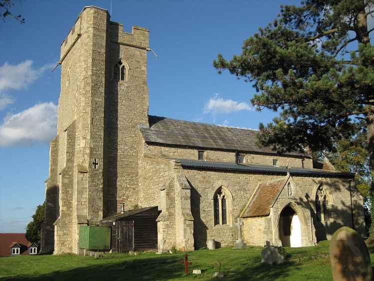
There are several old thatched dwellings. Other buildings are of brick apart from some concrete council houses to the west and the church which is of stone, and dates from the 12th century. There is an inn, the Carrington Arms, and a village hall, the Millennium Hall.