
Airport type Public Elevation AMSL 915 ft / 279 m Elevation 915 m Phone +33 4 70 20 03 79 | Location Toulon-sur-Allier 08/26 1,300 Code XMU | |
 | ||
Operator CCI de Moulins et Vichy Serves Moulins / Montbeugny, France Address Les Corats, 03400 Toulon-sur-Allier, France Similar Circuit Du Bourbonn, Charmeil Airport, Saint Yan Airport, Tourist Information Center, Allier Tourisme | ||
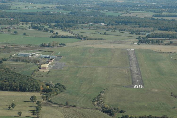
Moulins – Montbeugny Airport (French: Aérodrome de Moulins - Montbeugny) (ICAO: LFHY) is an aerodrome or airport located in Toulon-sur-Allier, 7 km (4 NM) southeast of Moulins and west of Montbeugny, all communes in the Allier department of the Auvergne region in central France.
Contents
Facilities
The airport resides at an elevation of 915 feet (279 m) above mean sea level. It has one runway designated 08/26 with an asphalt surface measuring 1,300 by 30 metres (4,265 ft × 98 ft). There are also two parallel grass runways measuring 843 by 80 metres (2,766 ft × 262 ft) and 330 by 30 metres (1,083 ft × 98 ft).
Airlines and destinations
There is no scheduled commercial air service at this time.
References
Moulins – Montbeugny Airport Wikipedia(Text) CC BY-SA