
Airport type Public 13/31 5,005 Code TGE Phone +1 334-727-6485 | Owner City of Tuskegee Elevation AMSL 264 ft / 80 m 5,005 1,526 Elevation 80 m | |
 | ||
Address 1721 General B O'Davis Junior Drive, Tuskegee, AL 36083, USA Similar Tuskegee University, Sharpe Field, Tuskegee Airmen Natl Histo, Auburn University Regional, Little Texas | ||
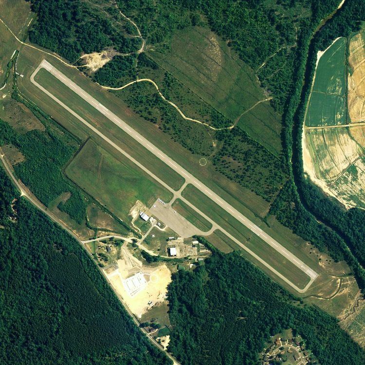
Moton Field Municipal Airport (FAA LID: 06A) is a public-use airport located three nautical miles (3.5 mi, 5.6 km) north of the central business district of Tuskegee, a city in Macon County, Alabama, United States. The airport is owned by the City of Tuskegee. It is included in the FAA's National Plan of Integrated Airport Systems for 2011–2015, which categorized it as a general aviation facility.
Moton Field is home to the Tuskegee Airmen National Historic Site.
Facilities and aircraft
Moton Field Municipal Airport covers an area of 275 acres (111 ha) at an elevation of 264 feet (80 m) above mean sea level. It has one runway designated 13/31 with an asphalt surface measuring 5,005 by 100 feet (1,526 x 30 m).
For the 12-month period ending December 9, 2009, the airport had 19,530 general aviation aircraft operations, an average of 53 per day. At that time there were 9 aircraft based at this airport: 100% single-engine.