
Length 502 km Mouth Oka River Country Russia | Basin area 17,600 km² Source Starkovskoe Swamp | |
 | ||
Bridges Krymsky Bridge, Bolshoy Kamenny Bridge Cities Moscow, Kolomna, Zvenigorod, Voskresensk, Moscow Oblast, Zhukovsky, Moscow Oblast, Mozhaysk, Bronnitsy | ||
Moskva river boat trip by the center of moscow real russia ep 48
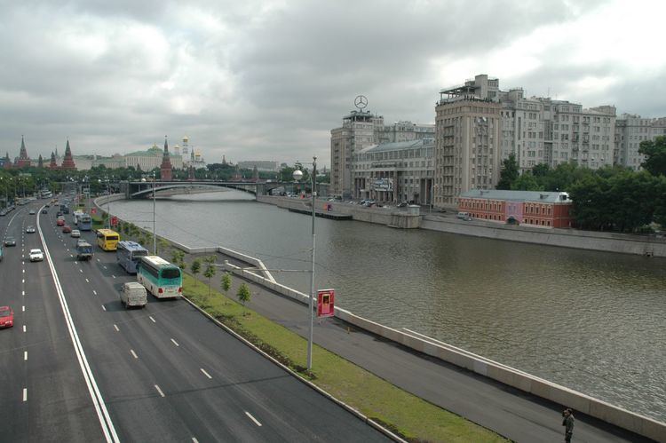
The Moskva River (Russian: река Москва, Москва-река, Moskva-reka) is a river of western Russia. It rises about 140 km (90 mi) west of Moscow, and flows roughly east through the Smolensk and Moscow Oblasts, passing through central Moscow. About 110 km (70 mi) south east of Moscow, at the city of Kolomna, it flows into the Oka River, itself a tributary of the Volga, which ultimately flows into the Caspian Sea.
Contents
- Moskva river boat trip by the center of moscow real russia ep 48
- Map of Moskva River Russia
- Etymology
- Hydrology
- Cities and towns
- Islands
- Recreation
- Gallery
- References
Map of Moskva River, Russia
Etymology
Moskva and Moscow are two different renderings of the same Russian word Москва. The city is named after the river. The origin of the name is unknown, although several theories exist.
Hydrology
The river is 503 km (313 mi) long, with a vertical drop of 155 m (509 ft) (long-term average). The area of its drainage basin is 17,600 km2 (6,800 sq mi). The maximum depth is 3 metres above Moscow city limits, and up to 6 metres below it. Normally, it freezes in November–December and begins to thaw around late March. In Moscow, the river freezes occasionally; during an unusually warm winter in 2006–2007, ice began melting on January 25. The absolute water level in downtown Moscow is 120.0 metres above sea level (long-term average of summer lows after World War II); a historical maximum of 127.25 metres above sea level was set by the 1908 flood.
Cities and towns
Moscow (Москва́), the capital of Russia, is situated on its banks. The river also flows through the towns of Mozhaysk, Zvenigorod, Zhukovsky, Bronnitsy, Voskresensk, and — at the confluence of the Moskva and Oka — Kolomna. As of 2007, there are 49 bridges across the Moskva River and its canals within Moscow city limits; the first stone bridge, Bolshoi Kamennyi Bridge, was erected in 1692. Within the city, the river is 120–200 metres wide, the narrowest point being under the Kremlin walls. Drinking water for the city of Moscow is collected from five stations on the Moskva River and from the Upper Volga reservoirs (north and north-west of the city).
Islands
Canals, built within Moscow city limits, have created a number of islands. Some of them have names in Russian, some have none. Major, permanent islands (west to east) are:
Recreation
There are five walking river ice breakers which ply on a route from a mooring Hotel Ukraine to the Novospassky Monastery and back. Duration of walk will make about 2 hours.