
Country United States Time zone Pacific (UTC-8) Elevation 50 m Population 433 (2013) Area code 541 | Incorporated 1914 FIPS code 41-50050 Zip code 97040 Local time Sunday 3:51 AM | |
 | ||
Weather 3°C, Wind NW at 5 km/h, 85% Humidity Area 166 ha (122 ha Land / 44 ha Water) | ||
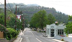
Twin tunnels longboarding mosier oregon
Mosier is a city in Wasco County, Oregon, United States. The population was 433 at the 2010 census.
Contents
- Twin tunnels longboarding mosier oregon
- Map of Mosier OR 97040 USA
- Herbie dani mosier oregon wedding
- History
- Geography
- Climate
- 2010 census
- 2000 census
- Notable residents
- References
Map of Mosier, OR 97040, USA
Herbie dani mosier oregon wedding
History
Mosier was first settled in 1854 and incorporated as a city in 1914. The building now known as the post office was at that time the bank, and the original safe is still intact on-site. Mosier School was built in 1920 and until 1963 was a 1st–12th grade 1A school. From 1964 to 2002 it functioned as part of the Chenowith School District as an elementary school that ranged from Kindergarten to fifth grade. In January 2003, the Chenowith School District approved the charter application for Mosier Elementary to become a charter school known as Mosier Community School.
On June 3, 2016, a 96-car oil train derailed near Mosier. 11 cars derailed and at least one caught on fire, only 20 feet away from the city's sewage treatment facility.
Geography
According to the United States Census Bureau, the city has a total area of 0.64 square miles (1.66 km2), of which, 0.47 square miles (1.22 km2) is land and 0.17 square miles (0.44 km2) is water.
Eighteenmile Island is located a half-mile downstream of the city in the Columbia River.
Climate
This region experiences warm (but not hot) and dry summers, with no average monthly temperatures above 71.6 °F. According to the Köppen Climate Classification system, Mosier has a warm-summer Mediterranean climate, abbreviated "Csb" on climate maps.
2010 census
As of the census of 2010, there were 433 people, 203 households, and 107 families residing in the city. The population density was 921.3 inhabitants per square mile (355.7/km2). There were 250 housing units at an average density of 531.9 per square mile (205.4/km2). The racial makeup of the city was 90.1% White, 0.2% African American, 2.3% Native American, 1.2% Asian, 0.7% Pacific Islander, 4.2% from other races, and 1.4% from two or more races. Hispanic or Latino of any race were 22.4% of the population.
There were 203 households of which 24.1% had children under the age of 18 living with them, 37.9% were married couples living together, 10.3% had a female householder with no husband present, 4.4% had a male householder with no wife present, and 47.3% were non-families. 37.4% of all households were made up of individuals and 11.4% had someone living alone who was 65 years of age or older. The average household size was 2.13 and the average family size was 2.83.
The median age in the city was 42.9 years. 21.7% of residents were under the age of 18; 5.5% were between the ages of 18 and 24; 26.8% were from 25 to 44; 30.1% were from 45 to 64; and 16.2% were 65 years of age or older. The gender makeup of the city was 48.5% male and 51.5% female.
2000 census
As of the census of 2000, there were 410 people, 164 households, and 104 families residing in the city. The population density was 9.005 people per square mile (344.1/km²). There were 191 housing units at an average density of 419.5 per square mile (160.3/km²). The racial makeup of the city was 85.61% White, 0.49% African American, 1.46% Native American, 0.98% Pacific Islander, 8.54% from other races, and 2.93% from two or more races. Hispanic or Latino of any race were 14.15% of the population.
There were 164 households out of which 27.4% had children under the age of 18 living with them, 51.2% were married couples living together, 11.0% had a female householder with no husband present, and 36.0% were non-families. 27.4% of all households were made up of individuals and 8.5% had someone living alone who was 65 years of age or older. The average household size was 2.50 and the average family size was 3.06.
In the city, the population was spread out with 25.6% under the age of 18, 6.6% from 18 to 24, 32.0% from 25 to 44, 22.2% from 45 to 64, and 13.7% who were 65 years of age or older. The median age was 37 years. For every 100 females there were 88.9 males. For every 100 females age 18 and over, there were 90.6 males.
The median income for a household in the city was $39,028, and the median income for a family was $46,094. Males had a median income of $30,521 versus $19,000 for females. The per capita income for the city was $14,560. About 1.7% of families and 5.3% of the population were below the poverty line, including none of those under age 18 and 13.0% of those age 65 or over.