Elevation 201 m (659 ft) Area 47.94 km² Population 3,712 (30 Jun 2009) Dialling code 05664 | District Schwalm-Eder-Kreis Time zone CET/CEST (UTC+1/+2) Postal code 34326 Local time Sunday 7:06 AM | |
 | ||
Weather 7°C, Wind S at 10 km/h, 95% Humidity | ||
Morschen is a community in the Schwalm-Eder district in Hesse, Germany.
Contents
- Map of 34326 Morschen Germany
- Location
- Constituent communities
- Municipal council
- Buildings
- Transport
- Honorary citizens
- References
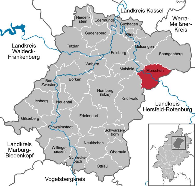
Map of 34326 Morschen, Germany
Location
Morschen lies in the Fulda valley south of Kassel.
Constituent communities
The community consists of the centres of Altmorschen (administrative seat), Binsförth, Eubach, Heina, Konnefeld, Neumorschen and Wichte.
Municipal council
Morschen's municipal council is made up of 23 members.
(as of municipal elections held on 26 March 2006)
Buildings
Kloster Haydau, a former Cistercian convent, was built between the mid 13th century and the early 14th century, and in the mid 16th century and 17th century it was converted into a stately home for a Landgrave. Today, the building is used for meetings and conventions, as a gallery, a meeting place for professors, and a venue for poetry readings.
Transport
Morschen lies on Federal Highway (Bundesstraße) B 83 (Kassel – Bebra). The Malsfeld Autobahn interchange (83) on the A 7 (Kassel – Würzburg) is about 11 km away.
The community belongs to the North Hesse Transport Network.
