
 | ||
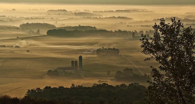
Morrisons Cove (also referred to as Morrison Cove or Morrison's Cove), is an eroded anticlinal valley in Blair and Bedford counties of central Pennsylvania, United States, extending from Evitts Mountain near New Enterprise, north to the Frankstown Branch Juniata River at Williamsburg. The width of the valley varies from 10 to 15 miles (16 to 24 km) between Tussey Mountain on the east to the chain of Dunning, Loop and Lock Mountains on the west. Almost entirely enclosed by these mountains, the only openings in the cove are at Loysburg Gap in the south, McKee Gap in the west, and at Williamsburg to the north. The floor of the valley is mostly level, with many large fertile farm fields. The southern end of the valley drains to the Raystown Branch Juniata River via Yellow Creek through Loysburg Gap, and the northern end drains to the Frankstown Branch, via Clover Creek.
Contents
There are 4 boroughs located in Morrisons Cove and they are:
There are 7 Townships located in Morrisons Cove and they are the following:
Although on the other side of Dunning Mountain, Claysburg could be included in this list because of the shared culture and customs of the area. [2]
Altoona–Blair County Airport and Cove Valley Airport are located in Morrisons Cove. Pennsylvania Route 36 is the main north/south route through the valley from Loysburg Gap to McKee Gap. Pennsylvania Route 866 branches off PA-36 at Woodbury to Martinsburg.
History
Morrisons Cove is often mentioned as a landmark in early wills and records of importance. Wills Creek Valley and Friend's Cove are also in this section of the state, and were well known to the early settlers.
Tornado
On May 22, 1949 the same storm system that caused the F1 tornado in Altoona also spawned an F1 tornado in the Morrisons Cove area. The tornado initially touched down south of Curryville where it downed several large trees and destroyed a barn. The tornado moved north east, striking Henrietta and Millerstown. Several homes were unroofed and barns were destroyed, in both areas. One of the destroyed barns was a 150-year-old stone barn. Near Henrietta, a three-hundred foot long chicken house was thrown a considerable distance before being destroyed. A car was destroyed and a church had several windows blown out and had its chimney ripped off. A 17-year-old girl was injured in Henrietta, when the window she was standing at shattered. The tornado dissipated about a mile east of Martinsburg in the Clover Creek/Fredericksburg area where it downed several willow trees. The damage caused by this tornado is consistent of winds 105-110MPH.
A map made by Dr. Ted Fujita, in 1974, of all of the tornadoes in the U.S between 1930 and 1974, shows this tornado as an F1 on the Fujita Scale.