
Type gulf | ||
 | ||
Settlements Alicia, Zamboanga Sibugay, Balabagan, Buug | ||
M 5 9 earthquake moro gulf mindanao philippines 09 03 12
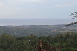
The Moro Gulf is the largest gulf in the Philippines. It located off the coast of Mindanao Island, and is part of the Celebes Sea. The gulf is one of the country's tuna fishing grounds.
Contents
- M 5 9 earthquake moro gulf mindanao philippines 09 03 12
- Map of Moro Gulf Philippines
- M 6 6 earthquake moro gulf mindanao philippines dec 2 2014
- Geography
- Earthquakes
- References
Map of Moro Gulf, Philippines
M 6 6 earthquake moro gulf mindanao philippines dec 2 2014
Geography
The gulf stretches between and is surrounded by the main section of Mindanao on the east, and the Zamboanga Peninsula of Mindanao on the west. The peninsula's major drainage goes towards the gulf.
Sibuguey Bay and Illana Bay are its major bays.
Zamboanga City, which is an international port, is bound by the Gulf and Celebes Sea in the East. Cotabato City, on the eastern coast, is another major port.
Earthquakes
The Moro Gulf is also an area of significant tectonic activity with several fault zones in the region capable of producing major earthquakes and destructive local tsunamis, such as the devastating 1976 Moro Gulf earthquake which killed over 5,000 people and left over 90,000 people homeless as it hit the west coast of Mindanao.