
Total islands 22 Highest point unnamed Area 1,002 km² | Archipelago Wellesley Islands Highest elevation 150 m (490 ft) Elevation 150 m | |
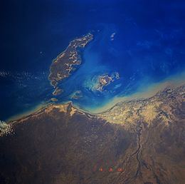 | ||
Discover mornington island gulf of carpentaria 2015
Mornington Island is the northernmost of 22 islands that form the Wellesley Islands group. The island is in the Gulf of Carpentaria and is part of the Gulf Country region in the Australian state of Queensland. The Manowar and Rocky Islands Important Bird Area lies about 40 kilometres (25 mi) to the north-west. Mornington is the largest of the islands.
Contents
- Discover mornington island gulf of carpentaria 2015
- Map of Mornington Island Queensland Australia
- Description
- History
- In literature
- Alcohol Management Plan
- References
Map of Mornington Island, Queensland, Australia
Description
The general topography of the island is flat with the maximum elevation of 500 feet (150 metres). The island is fringed by mangrove forests and contains 10 estuaries, all in near pristine condition.
The population was estimated to be 1,007 in 2001 and the majority of the citizens live in the township of Gununa. Mornington Island is included in the Shire of Mornington local government area. The majority of the islanders are Aboriginal.
Lardil are the predominant clan group on Mornington Island and are the traditional owners of the land and surrounding seas. The Kiadilt clan arrived more recently (1947) from nearby Bentinck Island, when that island's water supply was contaminated by salt after a cyclone. Recent re-building work on aboriginal housing has been undertaken by the James Fraser Foundation, a non-profit organisation in Queensland.
History
Macassan trepangers once travelled thousands of kilometres from Sulawesi to Mornington Island and other Australian mainland destinations in search of sea cucumbers. The eastern cape of the island was named Cape Van Diemen after Anthony van Diemen. Commander Matthew Flinders named the island after Richard Wellesley, 1st Marquess Wellesley who was known as The Earl of Mornington.
Gununa Post Office opened by 1892.
The Mornington Island Airport was a temporary airfield used by the RAAF and allied air forces during World War II.
Penile subincision was traditionally performed on the island for those wanting to learn a complex ceremonial language called Damin.
In 1978, the Queensland government decided to take over control of both the Aurukun and Mornington Island Aboriginal reserves.
Cyclones routinely hit the island. In 2000 Cyclone Steve passed directly over the island. Tropical Cyclone May passed in February 1988 and Tropical Cyclone Bernie passed to the west in early 2002. Tropical Cyclone Fritz passed directly over the island on 12 February 2003. Severe Tropical Cyclone Harvey caused damage on the island in February, 2005.
In literature
Mornington Island was the site of research over several decades by British anthropologist David McKnight, described in a series of books, People, Countries, and the Rainbow Serpent: Systems of classification among the Lardil of Mornington Island (1999), From Hunting to Drinking: The devastating effects of alcohol on an Australian Aboriginal community (2002), Going the Whiteman’s Way: Kinship and marriage among Australian Aborigines (2004) and Of Marriage, Violence and Sorcery: The quest for power in northern Queensland (2005). McKnight lamented the increasing levels of violence since the 1970s.
Indigenous art of Mornington Island is described in The Heart of Everything: The art and artists of Mornington & Bentinck Islands, ed. N. Evans, L. Martin-Chew and P. Memmott (2008).
A tribe of indigenous people on the island have been communicating with wild Indo-Pacific bottlenose dolphins for millennium. It is said that they have"a medicine man who calls the dolphins and “speaks” to them telepathically. By these communications he assures that the tribes’ fortunes and happiness are maintained."
Alcohol Management Plan
In 2003 the Government of Queensland implemented an Alcohol Management Plan to 19 indigenous communities in Queensland where alcohol abuse was rampant. The alcohol bans are aimed at alleviating high levels of domestic violence, child abuse and child neglect. The plan restricts tavern opening hours, limits sales to only light and mid-strength beers, bans takeaway alcohol sales and home brewing. The Mornington Island community has been described as the toughest in Queensland when it comes to resisting alcohol bans.
In December 2003 police reinforcements had to be sent to Mornington Island after riots broke out when tough new alcohol laws were introduced. In 2008 more riots were feared after the Lelka Murrin Hotel, one of only two liquor retailers on the island, closed due to the proprietor being ill. Extra police were sent to the island to stop any unauthorised sale of alcohol and to quash any alcohol-fueled violence that may have erupted at a time when violent incidents on the island were common.