Postal code 739 04 Elevation 520 m Local time Sunday 9:34 AM | Established 1615 Website www.moravka.info Area 87.35 km² Population 1,083 (2011) | |
 | ||
Weather -1°C, Wind NW at 21 km/h, 75% Humidity Points of interest Lyžařské středisko Morávka Sviňorky, Byčinec, Travný potok | ||
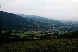
Morávka (German: Morawka, Polish: Morawka) is a village in Frýdek-Místek District, Moravian-Silesian Region, Czech Republic. It has a population of 1,030 (2006). Morávka lies in the Moravian-Silesian Beskids in the elevation of 520 m, in the historical region of Těšín Silesia.
Contents
Map of 739 04 Mor%C3%A1vka, Czechia
Morávka lies on the Morávka River. A dam was built on the river in the village in 1961–1964.
History
The village was first mentioned in 1641 as Morawka. It was then a part of the Friedek state country that was split from the Duchy of Teschen in 1573, which was a part of the Kingdom of Bohemia, since 1526 a part of the Habsburg Monarchy. After World War I and fall of Austria-Hungary it became a part of Czechoslovakia. In March 1939 it became a part of Protectorate of Bohemia and Moravia.
During World War II, the inhabitants of the village took part in the anti-Nazi resistance. In December 1944 the Nazis captured the guerrilla group and after interrogation and torture they obtained information about their supporters: 14 people of the village were executed, 10 were deported into a concentration camp. In 1978, a memorial of the guerrilla movement was declared a national cultural monument.
