
Max. length 9.8 mi (15.8 km) Length 15.77 km Area 14.12 km² | Primary inflows Basin countries United States Max depth 37 m Surface elevation 246 m Mean depth 18 m | |
 | ||
Cities Littleton, Waterford, Concord, Dalton | ||
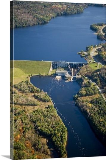
Moore Reservoir is an impoundment on the Connecticut River located in the communities of Littleton, New Hampshire; Dalton, New Hampshire; Waterford, Vermont; and Concord, Vermont. It occupies approximately 3,181 acres (12.87 km2).
Map of Moore Reservoir, United States
It was created by the completion of the Moore Dam in 1956, which caused the flooding of several villages, including Pattenville, New Hampshire, and old Waterford, Vermont. Moore Dam is now owned and operated by TransCanada Corporation. With a capacity of 192 megawatts, it is the most productive of TransCanada's thirteen hydroelectric facilities in New England.
The lake is classified as a cold- and warmwater fishery, with observed species including brook trout, rainbow trout, brown trout, smallmouth and largemouth bass, chain pickerel, horned pout, northern pike, and rock bass.