
Country United States County Coos Time zone Eastern (UTC-5) Elevation 279 m Population 979 (2010) | Incorporated 1764 Area code(s) 603 Zip code 03598 Local time Thursday 12:32 AM | |
 | ||
Weather 2°C, Wind SW at 10 km/h, 75% Humidity | ||
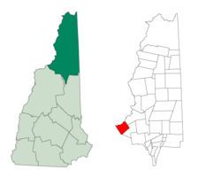
Dalton is a town in Coos County, New Hampshire, United States. The population was 979 at the 2010 census. It is part of the Berlin, NH–VT Micropolitan Statistical Area.
Contents
Map of Dalton, NH 03598, USA
History
Dalton was incorporated in 1764 under the name Chiswick, named for the Duke of Devonshire's castle. The name was changed to Apthorp in 1770, after the Apthorp family. The name Dalton was chosen in 1784, in honor of Tristram Dalton.
Geography
According to the United States Census Bureau, the town has a total area of 28.0 square miles (73 km2), of which 27.5 square miles (71 km2) is land and 0.5 square miles (1.3 km2) is water, comprising 2.00% of the town. The town's highest point is the summit of Dalton Mountain, at 2,146 feet (654 m) above sea level. The town includes the hamlet of Cushman, which is located on the Connecticut River, opposite Gilman, Vermont. Dalton lies fully within the Connecticut River watershed.
Approximately 82% of the town's land—14,390 acres (58.2 km2) out of a total land area of 17,624 acres (71.3 km2)—is undeveloped farm land, forest land or unproductive land enrolled in the state's current use program. The 14,390 acres (58.2 km2) of undeveloped land enrolled in current use is owned by 200 property owners, resulting in an average parcel size of 71.95 acres (291,200 m2) per current use owner. According to the town's property ownership records (available from the town clerk at town hall, 741 Dalton Road, Dalton, NH), the town's largest landowner, together with family members, owns in excess of 1,000 acres (4.0 km2) of land.
Demographics
As of the census of 2000, there were 927 people, 374 households, and 253 families residing in the town. The population density was 33.7 people per square mile (13.0/km²). There were 520 housing units at an average density of 18.9 per square mile (7.3/km²). The racial makeup of the town was 96.76% White, 0.76% African American, 0.54% Native American, 0.22% Asian, 0.22% from other races, and 1.51% from two or more races. Hispanic or Latino of any race were 1.94% of the population.
There were 374 households out of which 28.9% had children under the age of 18 living with them, 56.1% were married couples living together, 6.7% had a female householder with no husband present, and 32.1% were non-families. 24.1% of all households were made up of individuals and 13.4% had someone living alone who was 65 years of age or older. The average household size was 2.48 and the average family size was 2.95.
In the town, the population was spread out with 24.4% under the age of 18, 6.5% from 18 to 24, 27.2% from 25 to 44, 27.4% from 45 to 64, and 14.6% who were 65 years of age or older. The median age was 41 years. For every 100 females there were 106.0 males. For every 100 females age 18 and over, there were 104.4 males.
The median income for a household in the town was $35,625, and the median income for a family was $41,667. Males had a median income of $29,097 versus $20,089 for females. The per capita income for the town was $16,234. About 2.7% of families and 5.6% of the population were below the poverty line, including 6.3% of those under age 18 and 10.8% of those age 65 or over.