
Time zone CET (UTC+1) Area 735.5 km² Population 69,613 (2014) | ||
 | ||
Municipalities ListAlcanar, Amposta, Freginals, La Galera, Godall, Mas de Barberans, Masdenverge, Sant Carles de la Ràpita, Sant Jaume d'Enveja, Santa Bàrbara, La Sénia, Ulldecona Points of interest MónNatura Delta de l'Ebre, La Foradada (Montsià), Ebro, Puente colgante de Ampo, Sòl de Riu Destinations Sant Carles de la Ràpita, Deltebre, Amposta, Parque natural dels Ports, Ulldecona | ||
Catalunya des de l aire 21 montsi
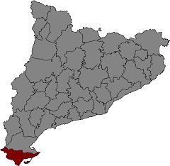
Montsià ([munsiˈa]) is the southernmost comarca (county) of Catalonia in Spain. Its capital and largest city is Amposta.
Contents
- Catalunya des de l aire 21 montsi
- Map of El MontsiC3A0 Tarragona Spain
- Monti i el proc s de conreu i producci de l arr s montsi
- History
- References
Map of El Montsi%C3%A0, Tarragona, Spain
Monti i el proc s de conreu i producci de l arr s montsi
History
The Montsià was first established as a separate administrative comarca in 1936 and was named after the Serra del Montsià mountain range (highest point 764 m). It is located at the southern end of Catalonia and the Sénia River marks the ancient boundary with the former Kingdom of Valencia. Many areas in this comarca have ancient passages and resting places of transhumant cattle herders, known locally as lligallos, that were very important in the past.
Almost all Montsià municipalities are part of the Taula del Sénia free association or mancomunitat (commonwealth).
References
Montsià Wikipedia(Text) CC BY-SA