
 | ||
Similar House of Dun, Montrose Air Station Heritage, Scurdie Ness, Montrose railway station, Bridge of Dun railway st | ||
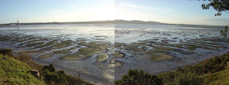
A montrose basin nature reserve walk
The Montrose Basin is part of the estuary of the South Esk forming a tidal basin near to the town of Montrose, Angus, on the east coast of Scotland.
Contents
- A montrose basin nature reserve walk
- Map of Montrose Basin Montrose UK
- Scotland montrose basin and wildfowl reserve
- References
Map of Montrose Basin, Montrose, UK
The nature reserve in this embayment is internationally important for pink-footed geese, red knot and common redshank and is nationally important for common shelduck, wigeon and common eider ducks. It is also popular with mute swans, oystercatchers and northern lapwings as well as smaller birds. Breeding birds are preyed on by peregrine falcons and sparrowhawks. The visitor centre, run by the Scottish Wildlife Trust, is accessible from the A92 road.
The swans give the Basin its old, more poetic name, the “Sea of Swans”.
The Montrose Basin Heritage Society was formed in 1999 to bring together information about the basin, including its history and archaeology.
The Basin has been exploited for its seafood. At one time Montrose was Scotland's second largest exporter of salmon; and mussel cultivation gave it the largest mussel beds in the country during the 19th and early 20th centuries. Eels have also been an important catch.
The Montrose Basin was hit by a tsunami in 6100 BC, generated by the massive underwater Storegga Slide, in Norway. It was 70 feet (21 m) high when it hit the basin, with the waters travelling inland as far as Forfar.