
Highest point Cervialto Country Italy | Province Province of Salerno Mountains Terminio, Cervialto | |
 | ||
Similar Sele, Monti Lattari, Monte Acellica, Alburni, Pizzo San Michele | ||
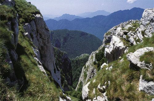
The Monti Picentini is a mountain range and national park in southern Italy, part of the Apennines, traditionally part in the Campanian Apennines. They are included between the Monti Lattari, the Partenio mount, the Irpinian plateau and the Sele river valley. The chain is included in the Monti Picentini Regional Park.
Contents
- Map of Monti Picentini 84095 Giffoni Valle Piana Province of Salerno Italy
- OverviewEdit
- RiversEdit
- References
Map of Monti Picentini, 84095 Giffoni Valle Piana, Province of Salerno, Italy
The highest peak is the Monte Cervialto (1,809 m), in the eastern sector, followed by the Monte Terminio (1,783 m), which is instead in the western part of the range.
OverviewEdit
The range is mostly made up of dolostone and limestone rocks, different from the surroundings areas, which are dominated by sandstone rocks. A central depression, joining the valleys of the Calore Irpino and Tusciano rivers, divided the range in two geologically different sectors: the western one, where rocks are predominantly dolostone, and the eastern one, mostly made up of limestone and has generally a less sharp landscape.
Karst topography is widely present, from which, in the valleys below, originates several springs.
Snow is present in winter over 1,000 m of altitude. Vegetation is generally low, somewhere mixed with chestnut woods.
RiversEdit
Rivers starting from the Monti Picentini include: