
Elevation 1,152 m | Province Province of Foggia | |
 | ||
Similar Monte Cornacchia, Monte Crispignano, Mount Saraceno, Monte Calvo, Matese | ||
Monti dauni
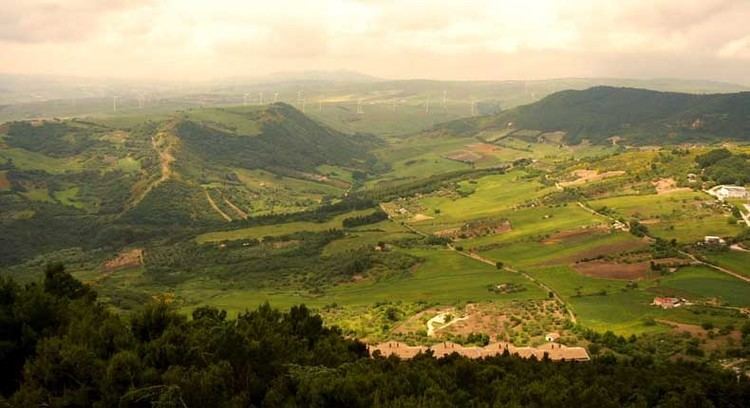
Monti Dauni (also known as Subappennino Dauno or Monti della Daunia) is a mountain range in southern Italy, constituting the eastern appendix of the Campanian Apennines. They occupy the eastern fringe of Capitanata and the border of Apulia with Molise, taking their name from an ancient Italic tribe, the Dauni.
Contents
- Monti dauni
- Map of Monti Dauni 71032 Biccari Province of Foggia Italy
- Tg monti dauni 03 02 2017
- References
Map of Monti Dauni, 71032 Biccari, Province of Foggia, Italy
The mountains and hills are bounded northwards by the Fortore valley, eastwards by the Tavoliere delle Puglie, southwards by the upper Ofanto valley. The chain is formed by sandstone terrains, and is the source of a series of small streams which flow through the Tavoliere into the Adriatic Sea. The highest peak is Monte Cornacchia, at 1,152 metres (3,780 ft).
Historically, the Monti Dauni area has suffered a substantial depopulation in the last decades, due to their relative isolation. They include 21 comuni, all in the province of Foggia, which form two mountain communities (Comunità Montana dei Monti Dauni Settentrionali , with seat at Casalnuovo Monterotaro, and the Comunità Montana dei Monti Dauni Meridionali, at Bovino).