
Elevation 4,097 m | Easiest route Scramble, class 2 Prominence 386 m | |
 | ||
Listing Desert Peaks Section List Similar Boundary Peak, Hayford Peak, White Mountain Peak, Grapevine Peak, Arc Dome | ||
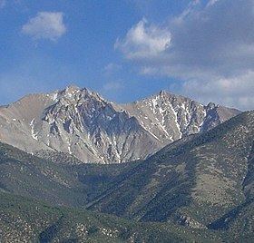
Montgomery Peak is a mountain in the White Mountains of California, USA. It is less than 1 mile (1.6 km) from Boundary Peak, the highest point in Nevada. It can be climbed in combination with Boundary Peak. The mountain is in the Inyo National Forest and White Mountains Wilderness.
Map of Montgomery Peak, California 93514, USA
References
Montgomery Peak Wikipedia(Text) CC BY-SA