Kalpana Kalpana (Editor)

Montelaterone

Updated on
Edit
Like
Comment
Share on FacebookTweet on TwitterShare on LinkedInShare on Reddit
Country
  
Italy

Comune
  
Arcidosso

Demonym(s)
  
Montelateronesi

Population
  
283 (2001)

Postal code
  
58030

Region
  
Tuscany

Elevation
  
670 m (2,200 ft)

Time zone
  
CET (UTC+1)

Province
  
Province of Grosseto

Dialling code
  
0564

Montelaterone

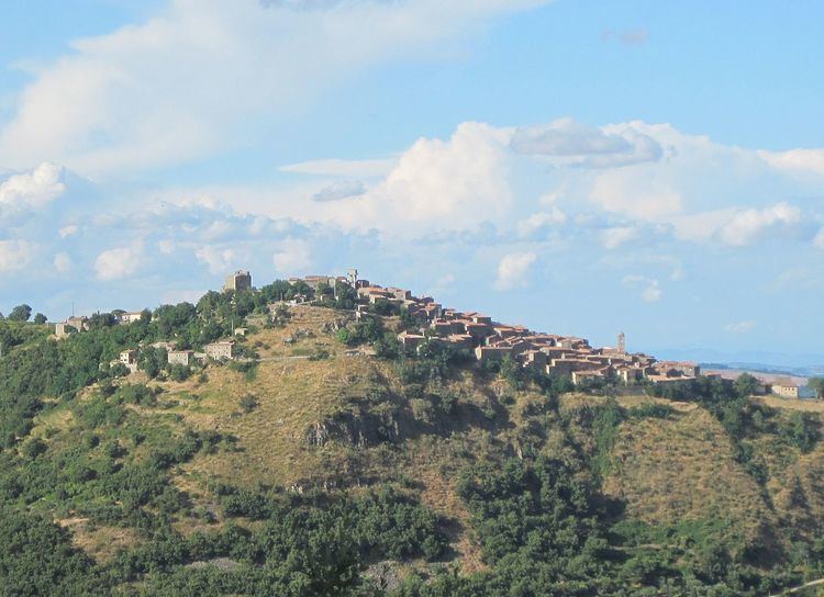
Montelaterone ([ˌmontelateˈroːne]) is a village in Tuscany, central Italy, administratively a frazione of the comune of Arcidosso, province of Grosseto, in the area of Mount Amiata. At the time of the 2001 census its population amounted to 283.

Contents

Map of 58031 Montelaterone, Province of Grosseto, Italy

Montelaterone is about 52 km from Grosseto and 4 km from Arcidosso, and it is situated on a sandstone peak between the valleys of Ente and Zancona rivers.

Main sights

  • Church of San Clemente (14th century), main parish church of the village
  • Church of Madonna della Misericordia (17th century), with frescoes by Francesco and Giuseppe Nicola Nasini
  • Chapel of Santa Lucia in Stiacciaie (14th century)
  • Pieve of Santa Maria a Lamula (12th century), between Montelaterone and Arcidosso, it is an important and ancient Romanesque church.
  • Palazzo Pretorio (13th century), ancient city hall
  • Walls of Montelaterone, old fortifications which surround the village since 11th century
  • Cassero Senese, a 13th-century fortress
  • References

    Montelaterone Wikipedia