
Established November 6, 1849 GNIS feature ID 0429386 Area 106.6 km² Local time Friday 8:04 PM | Time zone CST (UTC-6) Elevation 190 m Population 3,579 (2010) | |
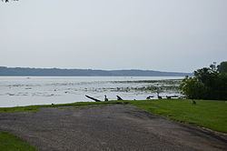 | ||
ZIP codes 62334, 62341, 62354, 62379 Weather 16°C, Wind NW at 13 km/h, 35% Humidity Points of interest Wildcat Springs Park, Montebello State Park, Lock and Dam No 19 | ||
Montebello Township is one of twenty-five townships in Hancock County, Illinois, USA. As of the 2010 census, its population was 3,579 and it contained 1,575 housing units.
Contents
- Map of Montebello Township IL USA
- Geography
- Cities towns villages
- Cemeteries
- Major highways
- Landmarks
- School districts
- Political districts
- References
Map of Montebello Township, IL, USA
Geography
According to the 2010 census, the township has a total area of 41.14 square miles (106.6 km2), of which 36.76 square miles (95.2 km2) (or 89.35%) is land and 4.38 square miles (11.3 km2) (or 10.65%) is water.
Cities, towns, villages
Cemeteries
The township contains these two cemeteries: Greenwood and Oakwood.
Major highways
Landmarks
School districts
Political districts
References
Montebello Township, Hancock County, Illinois Wikipedia(Text) CC BY-SA