
Elevation 118 m | ||
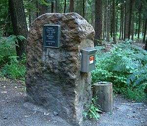 | ||
Monte Troodelöh is the highest point in the municipal area of the city of Cologne. It lies in the Rath/Heumar district, approximately 1,250 metres south of the A4 at Wolfsweg between the intersection of Pionier-Hütten-Weg and the Brück-Forsbacher Weg.
Contents
Map of Monte Troodel%C3%B6h, 51109 Cologne, Germany
OverviewEdit
It lies on rising ground in the middle of Königsforst at a height of 118 metres above sea level. Above the Wolfsweg there is a prominence which is 130 metres higher, but this point is on the far side of Cologne's city boundary and is officially a part of Bergisch Gladbach.
As recently as 1999, Monte Troodelöh was largely unknown. Today it is a destination on many suggested hiking routes and is considered a tourist attraction. This in spite of the fact that the spot offers neither an attractive view nor any rest-stops or amenities.