
Location Tuscany, Italy Mountain range Apuan Alps | Elevation 1,891 m Parent range Apuan Alps | |
 | ||
Province Province of Massa and Carrara Similar Monte Pisanino, Pania della Croce, Monte Sagro, Monte Grondilice, Monte Cavallo | ||
Monte tambura via vandelli hd
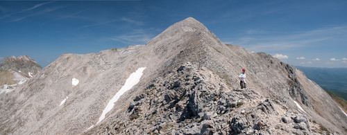
Monte Tambura is a mountain (1,891 m) in the Alpi Apuane, in Tuscany, central Italy. It is the second highest peak in the chain after Monte Pisanino. Located on the boundary between the province of Lucca and the province of Massa-Carrara, the Tambura is part of the Natural Regional Park of the Alpi Apuane.
Contents
- Monte tambura via vandelli hd
- Map of Monte Tambura 54100 Massa Province of Massa and Carrara Italy
- Monte tambura
- References
Map of Monte Tambura, 54100 Massa, Province of Massa and Carrara, Italy
Monte tambura
References
Monte Tambura Wikipedia(Text) CC BY-SA