
ZIP codes 45050, 45073, 45099 Elevation 254 m Local time Thursday 1:40 PM | Time zone Eastern (EST) (UTC-5) FIPS code 39-51310 Population 13,061 (2013) Area code 513 | |
 | ||
Weather 2°C, Wind W at 13 km/h, 32% Humidity Area 41.15 km² (41.1 km² Land / 5 ha Water) | ||
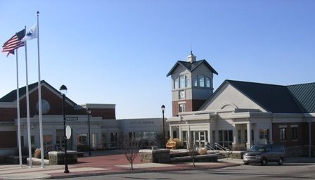
Monroe is a city located in east central Butler and west central Warren counties in the southwestern part of the U.S. state of Ohio. As of the 2010 Census, the city population was 12,442, up from 4,008 in 1990.
Contents
Map of Monroe, OH, USA
History
Monroe was laid out in 1817 on the Dayton and Cincinnati pike. The city is named for President James Monroe, fifth President of the United States.
In the early 1830s, Monroe contained one store and 119 inhabitants.
Geography
Monroe is located at 39°26′41″N 84°21′51″W (39.444658, −84.364044).
According to the United States Census Bureau, the city has a total area of 15.89 square miles (41.15 km2), of which 15.87 square miles (41.10 km2) is land and 0.02 square miles (0.05 km2) is water.
2010 census
As of the census of 2010, there were 12,442 people, 4,649 households, and 3,481 families residing in the city. The population density was 784.0 inhabitants per square mile (302.7/km2). There were 4,896 housing units at an average density of 308.5 per square mile (119.1/km2). The racial makeup of the city was 92.6% White, 3.7% African American, 0.2% Native American, 1.7% Asian, 0.7% from other races, and 1.3% from two or more races. Hispanic or Latino of any race were 1.8% of the population.
There were 4,649 households of which 39.2% had children under the age of 18 living with them, 61.6% were married couples living together, 8.8% had a female householder with no husband present, 4.5% had a male householder with no wife present, and 25.1% were non-families. 21.3% of all households were made up of individuals and 10.1% had someone living alone who was 65 years of age or older. The average household size was 2.63 and the average family size was 3.07.
The median age in the city was 36.9 years. 27% of residents were under the age of 18; 5.9% were between the ages of 18 and 24; 29.7% were from 25 to 44; 23.1% were from 45 to 64; and 14.3% were 65 years of age or older. The gender makeup of the city was 48.8% male and 51.2% female.
2000 census
As of the census of 2000, there were 7,133 people, 2,685 households, and 2,040 families residing in the city. The population density was 459.9 people per square mile (177.6/km²). There were 2,822 housing units at an average density of 182.0 per square mile (70.3/km²). The racial makeup of the city was 97.15% White, 1.42% African American, 0.10% Native American, 0.34% Asian, 0.22% from other races, and 0.77% from two or more races. Hispanic or Latino of any race were 0.64% of the population.
There were 2,685 households out of which 32.4% had children under the age of 18 living with them, 65.1% were married couples living together, 6.9% had a female householder with no husband present, and 24.0% were non-families. 20.3% of all households were made up of individuals and 9.3% had someone living alone who was 65 years of age or older. The average household size was 2.52 and the average family size was 2.91.
In the city the population was spread out with 22.8% under the age of 18, 6.5% from 18 to 24, 29.1% from 25 to 44, 22.6% from 45 to 64, and 19.0% who were 65 years of age or older. The median age was 40 years. For every 100 females there were 91.7 males. For every 100 females age 18 and over, there were 88.3 males.
The median income for a household in the city was $56,012, and the median income for a family was $62,528. Males had a median income of $44,864 versus $27,385 for females. The per capita income for the city was $24,735. About 1.0% of families and 1.9% of the population were below the poverty line, including 0.4% of those under age 18 and 2.1% of those age 65 or over.
Schools and utilities
Most of the city is in the Monroe Local School District with some falling in the Lakota School District. Telephone service is provided through the Monroe, Middletown, and Mason telephone exchanges. Mail is delivered through the Monroe, Middletown, and Lebanon post offices. There is a police station on the main road.