
Country United States County Walton ZIP codes 30655-30656 Elevation 277 m Local time Thursday 1:37 PM | Time zone Eastern (EST) (UTC-5) Area code(s) 470/678/770 Population 13,466 (2013) | |
 | ||
Weather 9°C, Wind W at 11 km/h, 22% Humidity Area 27.19 km² (26.94 km² Land / 26 ha Water) Points of interest Felker Park, McDaniel‑Tichenor House, Monroe Visitors Center, Matthews Park | ||
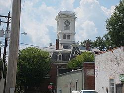
Monroe is a city in and the county seat of Walton County, Georgia. It is located east of Atlanta and is part of the Atlanta metropolitan area. The population was 13,234 at the 2010 census.
Contents
- Map of Monroe GA USA
- History
- Geography
- Demographics
- Walton County School District
- Elementary
- Middle
- High
- Private
- Notable natives
- Economy
- References
Map of Monroe, GA, USA
History
Monroe was founded in 1818 as seat of the newly formed Walton County. It was incorporated as a town in 1821 and as a city in 1896.
Monroe was the premier cotton producer in the state of Georgia during the 1900s. The two main cotton mills in Monroe used to be the driving economic force in the region. Now the mills no longer produce for the cotton industry, but rather serve as economic engines for the region by showcasing premiere antique markets, event space, and other unique retail.
Geography
Monroe is located at 33°47′36″N 83°42′39″W (33.793295, -83.710790).
According to the United States Census Bureau, the city has a total area of 10.5 square miles (27 km2), of which 10.4 square miles (27 km2) is land and 0.1 square miles (0.26 km2) (1.05%) is water.
Demographics
As of the 2010 United States Census, there were 13,234 people residing in the city. The racial makeup of the city was 51.8% White, 42.2% Black, 0.1% Native American, 0.8% Asian, 0.0% Pacific Islander, 0.2% from some other race and 1.6% from two or more races. 3.4% were Hispanic or Latino of any race.
As of the census of 2000, there were 11,407 people, 4,287 households, 2,983 families residing in the city. The population density was 1,101.3 people per square mile (425.1/km²). There were 4,637 housing units at an average density of 447.7 per square mile (172.8/km²). There were 4,287 households out of which 33.9% had children under the age of 18 living with them, 39.2% were married couples living together, 25.7% had a female householder with no husband present, and 30.4% were non-families. 25.7% of all households were made up of individuals and 10.4% had someone living alone who was 65 years of age or older. The average household size was 2.59 and the average family size was 3.07.
In the city, the population was spread out with 28.7% under the age of 18, 10.7% from 18 to 24, 28.6% from 25 to 44, 19.2% from 45 to 64, and 12.8% who were 65 years of age or older. The median age was 32 years. For every 100 females there were 83.8 males. For every 100 females age 18 and over, there were 80.1 males. Current mayor is Greg Thompson.
The median income for a household in the city was $27,500, and the median income for a family was $31,568. Males had a median income of $30,717 versus $23,028 for females. The per capita income for the city was $16,636 (2008). About 19.8% of families and 22.9% of the population were below the poverty line, including 34.2% of those under age 18 and 17.1% of those age 65 or over.
The racial makeup of the city is 54.69% White, 42.24% African American, 0.21% Native American, 0.36% Asian, 0.04% Pacific Islander, 1.26% from other races, and 1.20% from two or more races. 2.52% of the population are Hispanic or Latino of any race.
Walton County School District
The Walton County School District holds pre-school to grade twelve, and consists of nine elementary schools, three middle schools, and four high schools. The district has 675 full-time teachers and over 10,368 students.
Elementary
Middle
High
Private
Notable natives
Economy
The east end of the City of Monroe on Unisa Drive contains multiple industries.