
Country United States Time zone Central (CST) (UTC-6) FIPS code 55-53550 Elevation 435 m Population 324 (2010) | Area code(s) 715 & 534 GNIS feature ID 1583734 Local time Wednesday 5:27 PM | |
 | ||
Weather 0°C, Wind NW at 8 km/h, 30% Humidity Area 93.24 km² (91.43 km² Land / 181 ha Water) Points of interest Lost Lake Esker State Natural Area, South Twin Lake, Sackett Lake Beach, Twin Lakes Bog State Natural Area | ||
Molitor is a town in Taylor County, Wisconsin, United States. The population was 324 at the 2010 census.
Contents
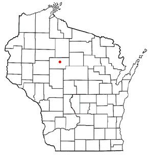
Map of Molitor, WI, USA
Geography
According to the United States Census Bureau, the town has a total area of 36.0 square miles (93.1 km²), of which, 35.3 square miles (91.4 km²) of it is land and 0.7 square miles (1.7 km²) of it (1.86%) is water.
Most of Molitor is hilly, with small glacial lakes. It lies within the Perkinstown terminal moraine, which is described under Taylor County.
History
The east side of the six mile (10 km) square that would become Molitor, which lies on the Fourth Principal Meridian, was first surveyed in May 1847 by a crew working for the U.S. government. Then in the winter of 1857 and 1858 another crew marked all the section corners in the township, walking through the woods and over frozen swamps, measuring with chain and compass. When done, the deputy surveyor filed this general description:
This Township contains numerous Tamarac and Cedar swamps but very few of much extent and Generally unfit for cultivation. The Surface is Broken and mostly 2nd rate soil and not very good for cultivation. Timber is very heavy all over the Township. Chiefly Hemlock Birch Pine and Tamarac. Tamarac and Spruce Trees principally line the Streams. There are several lake in this Township but not of much extent. There are numerous small streams running in a Northerly(?) direction (?) of which are generally Swampy among those are the East Branch of Yellow River raises in the South Easter portion of the Township and runs in a Northwesterly direction through the Township it flows(?) in a gentle current Deep and narrow not well adapted for good motive power or mills.
In 1933 much of Grover was designated part of the Chequamegon National Forest
Demographics
As of the census of 2000, there were 263 people, 100 households, and 80 families residing in the town. The population density was 7.5 people per square mile (2.9/km²). There were 142 housing units at an average density of 4.0 per square mile (1.6/km²). The racial makeup of the town was 98.48% White, 0.38% Native American, 0.76% from other races, and 0.38% from two or more races. Hispanic or Latino of any race were 0.76% of the population.
There were 100 households out of which 31.0% had children under the age of 18 living with them, 72.0% were married couples living together, 5.0% had a female householder with no husband present, and 20.0% were non-families. 17.0% of all households were made up of individuals and 5.0% had someone living alone who was 65 years of age or older. The average household size was 2.63 and the average family size was 2.96.
In the town, the population was spread out with 25.1% under the age of 18, 7.2% from 18 to 24, 27.8% from 25 to 44, 28.5% from 45 to 64, and 11.4% who were 65 years of age or older. The median age was 40 years. For every 100 females there were 113.8 males. For every 100 females age 18 and over, there were 101.0 males.
The median income for a household in the town was $37,500, and the median income for a family was $43,750. Males had a median income of $28,750 versus $20,568 for females. The per capita income for the town was $18,804. About 13.1% of families and 13.4% of the population were below the poverty line, including 31.7% of those under the age of eighteen and none of those sixty five or over.