
- summer (DST) CEST (UTC+2) Area 19.76 km² | Elevation 216 m Local time Wednesday 9:23 PM | |
 | ||
Weather 4°C, Wind N at 6 km/h, 68% Humidity | ||
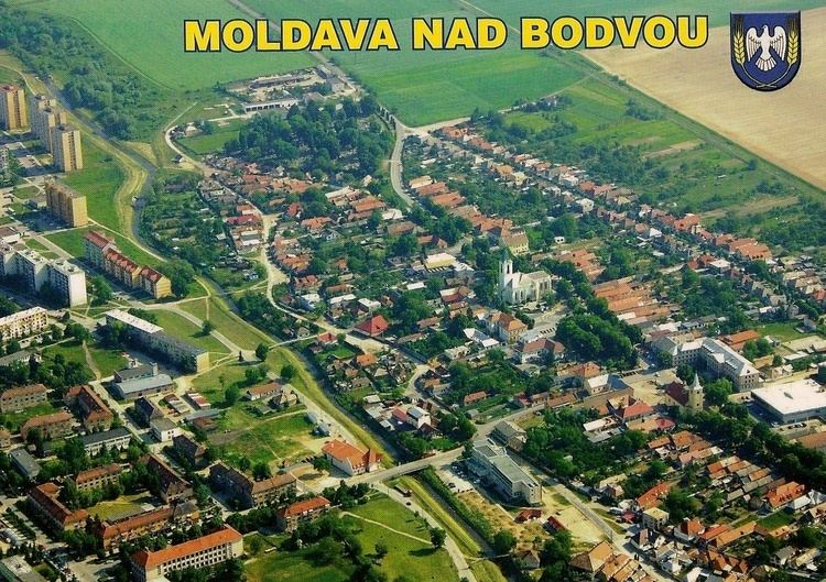
Moldava nad Bodvou (Hungarian: Szepsi. German: Moldau (an der Bodwa)) is a town and municipality in Košice-okolie District in the Košice Region of eastern Slovakia.
Contents
- Map of 045 01 Moldava nad Bodvou Slovakia
- History
- Geography
- Demographics
- Economy
- Twin towns Sister cities
- References
Map of 045 01 Moldava nad Bodvou, Slovakia
History
In historical records the town was first mentioned in 1255.
Geography
The town lies at an altitude of 216 metres and covers an area of 19.765 km2 (7.63 sq mi). It has a population of about 11,000 people.
Demographics
According to the 2011 census, the town had 11,086 inhabitants. 45% of inhabitants were Slovaks, 40% Hungarians, and 15% Roma. The religious make-up was 73.61% Roman Catholics, 6.91% people with no religious affiliation, 3.42% Greek Catholics and 1.12% Lutherans.
Economy
The town has a police force and fire service and its own tax office.
Twin towns — Sister cities
Moldava nad Bodvou is twinned with:
References
Moldava nad Bodvou Wikipedia(Text) CC BY-SA