
- left Vad, Tsna - elevation 79 m (259 ft) Basin area 51,000 km² | - right Sivin, Satis - average 95 m/s (3,355 cu ft/s) Country Russia | |
 | ||
- location Privolzhskaya Upland, Mokshansky District, Penza Oblast - location Oka River, Pitelinsky District, Ryazan Oblast | ||
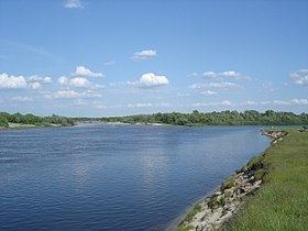
Moksha (Russian: Мо́кша) is a river in central Russia, a right tributary of the Oka River. It flows through Penza Oblast, Nizhny Novgorod Oblast, Ryazan Oblast and the Republic of Mordovia, and joins the Oka near Pyatnitsky Yar, below the city of Penza Oblast.
Contents
Map of r. Moksha, Penza Oblast, Russia
It is 656 kilometres (408 mi) in length, and has a drainage basin of 51,000 square kilometres (20,000 sq mi).
In the 1950s, several hydroelectric power stations were built in the middle course of the river, but without navigable locks. In 1955, 2 km below the mouth of the river. Prices on the Moksha River built Rasypukhinsky hydro-power plant with a hydroelectric power station and a wooden shipping lock. Navigation on the river was carried out until the mid-1990s.
On the Moksha is the Trinity-Scans monastery, the Nativity-Theotokos Sanaksar Monastery and the Krasnoslobodsky Savior-Transfiguration Monastery.
Origin of name
The name is left by the ancient Indo-European population of the Pohje, speaking a language close to the Baltic. Hydronym is comparable with the Indo-European basis meksha, meaning "spillage, leakage". It is suggested that in the language of Indo-European aborigines moksha meant "stream, current, river" and as a term entered into a series of hydronyms (Shirmksha, Mamoksha, etc.).
The name "Moksha" is mentioned by the monk-minorite Rubruk, the ambassador of the French King Louis IX to the Mongolian khan Sartak (1253).
Source
In the monograph "The Nature of the Penza Region" it is pointed out that p. Moksha originates from above. Lookout Nechaevsky (now Mokshan district) of the Penza region. According to the latest information, Moksha begins in a ravine from the springs system near the village of Elizavetino. The source of Moksha is on a treeless place. Research conducted in 2009-2010. Showed that from the south with. Lookout among the elevated places stretches low (up to Elizavetino) about 6 km long. This site is called "Dry Moksha". In the hollow with a sandy and clay bottom 20-40 cm deep, a creeping stream of 0.5-1.5 cm in width runs (the study was conducted in May 2010). The constant flow of water is observed below the confluence of the hollow from the holy spring, where a small extension of the channel also forms. A true watercourse flows towards Vision in a poorly developed channel. In some places, the banks collapse in the face of the knocking out of them groundwater flowing into the channel. The bottom of the lowland where the stream flows is swamped. Along the banks of the stream, shrubs of willows, thickets of broadleaf cattails, reeds of forest and some other moisture-loving plants grow in the water. Thus, the source of Moksha is a drying creek, now fueled by thawed and groundwater. It stretches to c. The look gradually turning into a constant stream.