
Country India State District | Languages spoken Hindi, Magadhi Region Magadh Literacy 96.00% | |
 | ||
Map of Mokama
Mokama is a Town and a municipality in Patna district in the Indian state of Bihar. It is located 90 km east of Patna on the southern banks of the river Ganges and is a station on the rail route connecting Kolkata to New Delhi via Patna. It is said that Mokama (मोकामा) fell on the route of the armies moving along the river Ganges during the Mughal and British periods. It was their resting place or Mukam (मुकाम), which means destination in Hindustani. Thus the name Mokama came into being over the years.
Contents
- Map of Mokama
- Shrine feast of the mother of divine grace in mokama
- Geography
- Economy
- Transport
- Demographics
- Folklore
- Indian independence movement
- Criminals
- References
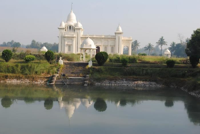
Shrine feast of the mother of divine grace in mokama
Geography
Mokama is situated on the southern banks of the Ganges. The landscape here is absolutely plain. The strip of land running along the northern bank of Ganges is called diara land in local parlance. The diara land submerges in Ganges waters during monsoons. To the south of Mokameh town lie the tal wetlands. The tal wetlands get submerged under the rising waters of the Ganges during the monsoons.
Some of the important localities which fall under Mokama Municipality are Sakarwar Tola, Moldiar Tola,laheriya tola, Dheorani Tola, Kowabhong and Chintamanichak, Sahwegpur , Shikharichak, Panchmahala , Tatwa Toli, Dr. Toli, Farsi Muhalla, Indira Nagar, Bhagwan Pur, Modan Gachi, Chandvari, Chatarpura, Modan Tola, Kachra Muhalla, & Aunta Gram. C.R.P.F. group centre is situated at the banks of the Ganges and R.P.F. training centre lies adjacent to it.
Economy
The main occupation is agriculture and the town is surrounded by farmlands. Major crops include lentils, chickpeas, mustard seeds. Many varieties of vegetables are grown here too. Papaya, guava and mango are some of the common fruits cultivated. However, major parcels of the Diara and Tal lands remain submerged for three months a year.
Mokama was developing as a market and trading place but it's economy faltered due to a sharp rise in crime rates.
Factories include those of McDowell's and Bata Shoes, along with Bharat Wagon and Engineering.
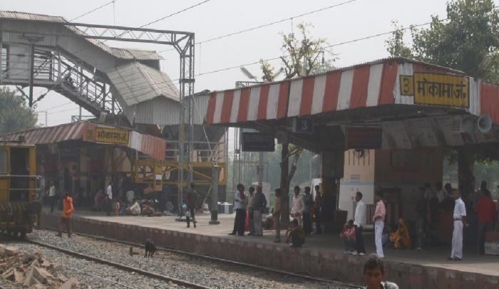
Transport
Mokama is connected to all the major cities of India by rail and road. Maranchi is the junction point of NH 80 and NH 31. Mokama Junction is the railway station .
Demographics
As of 2001 India census, Mokama had a population of 96,441. Males constitute 53% of the population and females 47%. Mokama has a literacy rate of 96%, higher than the national average of 69.5%: male literacy is 99%, and female literacy is 93%. In Mokama, 16% of the population is under 6 years of age. There is a CRPF base group centre and a RPF training centre at Mokama.
Folklore
The romantic folk story of Reshma and Chuharmal is commemorated with an annual fair.
Also every year in December a fair is organised in the Nazrath Church compound in the memory of Mother Mary.
Indian independence movement
The place where the revolutionary freedom fighter Prafulla Chaki was martyred is marked by a shaheed gate. People commemorate the anniversary of his death every year.
Criminals
Mokama has a history of being fertile ground for criminals. Nata Singh, Surajbhan Singh, Anant Singh and many other criminals are known nationally for the crime committed by them.A Lot of criminal aactivites started taking place here such as murders and thugs as the youngsters here started idialising there criminals.