
Last eruption Middle Pleistocene | Elevation 4,263 m | |
 | ||
Similar Imbabura Volcano, Cayambe, Cotacachi Volcano, Illiniza, Pululagua | ||
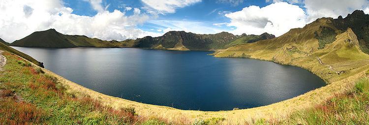
Mojanda is an inactive stratovolcano of the Eastern Cordillera of the Andes in northern Ecuador. A summit caldera, which was produced by an explosive Plinian Eruption that marked the end of Mojanda activity 200,000 years ago, is occupied by three crater lakes: Karikucha (the largest), Yanakucha, and Warmikucha. Having received protected status in 2002, they are a popular tourist destination and are about 20 minutes taxi ride from the largely indigenous town of Otavalo.
Map of Mojanda, Ecuador
Mojanda is a complex of two volcanoes which were active simultaneously. The volcanic vents are only 3 km apart. The other volcano, which produced at least two Plinian Eruptions of its own, is known as Fuya Fuya. Fuya Fuya partially collapsed around 165,000 years ago, creating a large caldera to the west. A new volcanic cone and other lava domes subsequently extruded inside the caldera, probably during the Late Pleistocene.
The high altitude grasslands and shrublands of Mojanda, which lie above the cloud forests, are collectively known as páramo. They are frequently grazed by cattle.