
Island group Comoro Islands Area - Total211 km2
81 sq mi | Capital Fomboni Population - 2006 estimate38,000 | |
Moheli, also known as Mwali, is one of the three islands which make up the nation of Comoros.
Contents
Map of Moheli
Population
Its population, as of 2006, is about 38,000.
Capital
Its capital city is Fomboni.
Ethnic groups
Its main ethnic group, as on the other Comoros islands Grande Comore and Anjouan as well as the French territory Mayotte, is the Comorian ethnic group, a synthesis of Bantu, Arab, Malay and Malagasy culture, and the main religion is Sunni Islam.
Protected areas
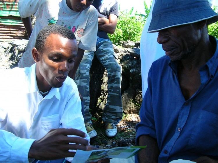
On 19 April 2001, the first protected area in this country – Moheli Marine Park – was gazetted. This was the culmination of a unique process by which the local communities in the ten villages around the park boundaries negotiated a collaborative arrangement with the government for the establishment and management of the park.
Not surprisingly therefore, the marine park programme was among the 27 finalists selected from nearly 500 nominations by the Equator Initiative, a partnership between the United Nations Development Programme (UNDP), IUCN, the UN Foundation and four other international groups, to promote community-based initiatives aimed at furthering sustainable development.
Location
Moheli is located in the Indian Ocean off the coast of Africa. It is by far the smallest of the Comoros islands.
History
Until 1830, Moheli was part of the Ndzuwenie Sultanate, which also controlled the neighbouring island of Anjouan. In 1830, migrants from Madagascar led by Ramanetaka, who later changed his name to Abderemane, took over the island and established the sultanate of Mwali. In 1886, France made the island a protectorate.
Until 1889, Mwali had its own French resident, but the island was then subjugated to the residency of Anjouan. The sultanate was crushed in 1909 when the French annexed the island. French colonial stamps inscribed Moheli were issued from 1906 to 1912.