
Country United States County Renville FIPS code 38-53780 Elevation 500 m Zip code 58761 Local time Wednesday 8:27 AM | Time zone Central (CST) (UTC-6) GNIS feature ID 1030268 Area 2.8 km² Population 819 (2013) Area code 701 | |
 | ||
Weather -8°C, Wind SE at 16 km/h, 90% Humidity | ||
Mohall is a city in Renville County, North Dakota, United States. It is the county seat of Renville County. The population was 783 at the 2010 census. Mohall is part of the Minot Micropolitan Statistical Area.
Contents
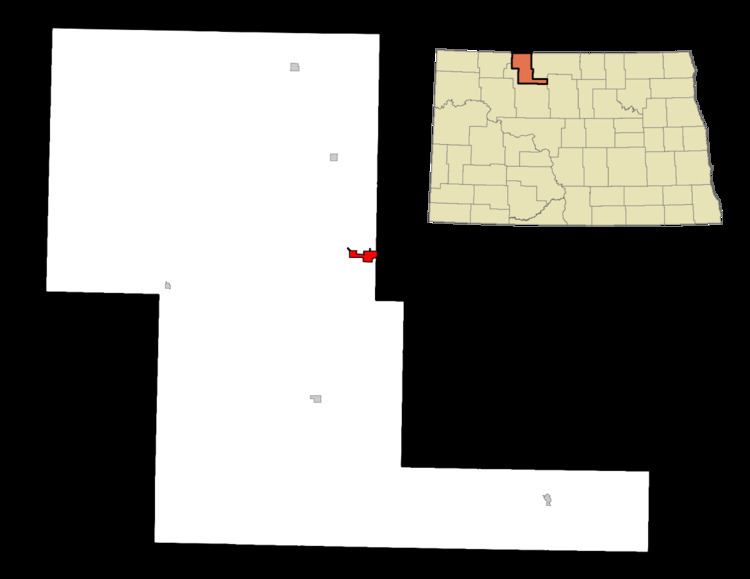
- Map of Mohall ND 58761 USA
- History
- Geography
- Mohall Municipal Airport
- 2010 census
- 2000 census
- Education
- Notable people
- Climate
- References
Map of Mohall, ND 58761, USA
History
Mohall was founded in 1901 by M.O. Hall, a businessman from Duluth, Minnesota. The city was originally named Hall but this conflicted with another community in North Dakota with the same name, so it was changed to Mohall in 1902. In 1910, Mohall was established as the county seat for Renville County.
Geography
Mohall is located at 48°45′54″N 101°30′40″W (48.765010, -101.511043). According to the United States Census Bureau, the city has a total area of 1.08 square miles (2.80 km2), all of it land.
Mohall Municipal Airport
The Mohall Municipal Airport is located at 48°46′06.2″N 101°32′13.2″W (48.7683833, -101.5369953), about a mile west of Mohall proper. Beginning operations in December 1944, the airport is owned by the city.
2010 census
As of the census of 2010, there were 783 people, 321 households, and 199 families residing in the city. The population density was 725.0 inhabitants per square mile (279.9/km2). There were 372 housing units at an average density of 344.4 per square mile (133.0/km2). The racial makeup of the city was 97.1% White, 0.3% African American, 1.1% Native American, 0.1% Asian, 0.4% from other races, and 1.0% from two or more races. Hispanic or Latino of any race were 1.3% of the population.
There were 321 households of which 28.7% had children under the age of 18 living with them, 49.8% were married couples living together, 9.3% had a female householder with no husband present, 2.8% had a male householder with no wife present, and 38.0% were non-families. 34.0% of all households were made up of individuals and 16.8% had someone living alone who was 65 years of age or older. The average household size was 2.27 and the average family size was 2.90.
The median age in the city was 44.8 years. 22.3% of residents were under the age of 18; 6.9% were between the ages of 18 and 24; 21.3% were from 25 to 44; 26.1% were from 45 to 64; and 23.5% were 65 years of age or older. The gender makeup of the city was 49.7% male and 50.3% female.
2000 census
At the 2000 census, there were 812 people, 340 households and 214 families residing in the city. The population density was 747.9 per square mile (287.6/km²). There were 397 housing units at an average density of 365.6 per square mile (140.6/km²). The racial makeup of the city was 98.40% White, 0.74% Native American, 0.25% Asian, and 0.62% from two or more races. Hispanic or Latino of any race were 0.25% of the population.
There were 340 households of which 25.6% had children under the age of 18 living with them, 52.9% were married couples living together, 7.6% had a female householder with no husband present, and 36.8% were non-families. 35.0% of all households were made up of individuals and 21.2% had someone living alone who was 65 years of age or older. The average household size was 2.22 and the average family size was 2.88.
Age distribution was 20.9% under the age of 18, 4.8% from 18 to 24, 20.8% from 25 to 44, 23.3% from 45 to 64, and 30.2% who were 65 years of age or older. The median age was 48 years. For every 100 females there were 88.0 males. For every 100 females age 18 and over, there were 85.5 males.
The median household income was $30,139, and the median family income was $38,636. Males had a median income of $27,344 versus $16,776 for females. The per capita income for the city was $17,341. About 8.8% of families and 10.9% of the population were below the poverty line, including 11.8% of those under age 18 and 5.6% of those age 65 or over.
Education
The Mohall, Sherwood, and Lansford school districts consolidated into the Mohall Lansford Sherwood School District in 2005. In order to minimize controversy, the three school districts' old nicknames were retired. Voters in the consolidated districts chose as the new nickname the Mavericks. Before the consolidation, the nickname for the Mohall school district was the Yellowjackets.
Notable people
Climate
This climatic region is typified by large seasonal temperature differences, with warm to hot (and often humid) summers and cold (sometimes severely cold) winters. According to the Köppen Climate Classification system, Mohall has a humid continental climate, abbreviated "Dfb" on climate maps.