
Topo map OS Landranger 124 Prominence 385 m | OS grid SH658448 Elevation 770 m | |
 | ||
Listing Marilyn, Hewitt, Nuttall Pronunciation Welsh: [ˈmɔilwɨn ˈmaur] Similar Moelwyn Bach, Cnicht, Manod Mawr, Moel‑yr‑hydd, Moel Siabod | ||
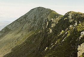
Moelwyn mawr north ridge top nuttalls part 9
Moelwyn Mawr is a mountain in Snowdonia, North Wales and forms part of the Moelwynion. From its summit, which directly overlooks the Vale of Ffestiniog, it affords spectacular views in all directions.
Contents
- Moelwyn mawr north ridge top nuttalls part 9
- Map of Moelwyn Mawr Blaenau Ffestiniog UK
- Site of Special Scientific Interest
- Quarrying
- Walking
- References
Map of Moelwyn Mawr, Blaenau Ffestiniog, UK
Site of Special Scientific Interest
In 1990, Moelwyn Mawr was designated a Site of Special Scientific Interest of national scientific importance. The glaciated landscape of the mountain provides fine examples of two specific Pleistocene features. On the north-east flank of the mountain is a terrain of patterned ground, consisting of small-scale vegetated stripes. On the west side, a debris tongue formed by a rock glacier extends into Cwm Croesor.
Quarrying
Slate quarrying was a major industry for many years in the Moelwynion. Moelwyn Mawr's flanks have several major quarries on them. To the west is Croesor Quarry perched high above Cwm Croesor. To the north west is Rhosydd Quarry on the col between Cwm Croesor and Cwm Orthin. Within Cwm Orthin, Conglog and Wrysgan quarries are located on the north slope of the mountain. Within Cwm Ystradau to the east lies Moelwyn Slate Quarry.
Walking
A popular hike combines both Moelwyn Mawr and Moelwyn Bach via the Craigysgafn ridge.
A steep climb to the summit (which has a trig point) allow views of areas that cannot be seen without climbing.
Moelwyn Mawr has a high reservoir, Llyn Stwlan, which is part of the Ffestiniog Power Station pumped-storage hydroelectric power plant in Tanygrisiau.
The walk over the main peaks in the Moelwyns, those being Moelwyn Mawr and Moelwyn Bach involves a walk up a disused incline, before gaining the grassy slopes of Moelwyn Mawr and onto the rockier Moelwyn Bach, before walking back down the road from the Stwlan Dam. Both the Snowdonia and Harlech Ordnance Survey maps are needed to cover the walk. Transport to the beginning may be done by car to Tanygrisiau or Ffestiniog, or by train from Llandudno Junction.