
Topo map OS Landranger 124 Prominence 162 m | OS grid SH 62623 24592 Elevation 589 m Listing Dewey | |
 | ||
Similar Y Llethr, Rhinog Fach, Diffwys, Rhinog Fawr, Y Garn | ||
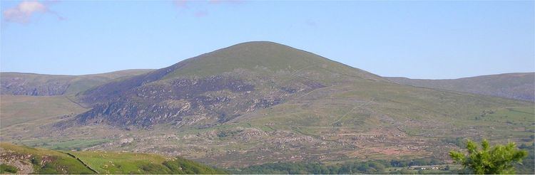
Moelfre is a hill in Wales on the far western edge of the Snowdonia National Park, 3 miles from the village of Dyffryn Ardudwy, 5 miles from the village of Llanbedr and about 10 miles from the town of Harlech. It forms part of the Rhinogydd range. Moelfre reaches a height of 589 metres.
Map of Moelfre, Talybont, UK
Moelfre is a prominent peak that separates Cwm Nantcol from Ysgethin Valley. Moelfre is also known for a legend of three women who worked on the Sabbath and were turned into standing stones.
References
Moelfre (hill) Wikipedia(Text) CC BY-SA