
- elevation 76 m (249 ft) | ||
 | ||
- location Thanon Thongchai Range, Tak Province, Thailand - location Sop Moei, Mae Hong Son Province, Thailand | ||
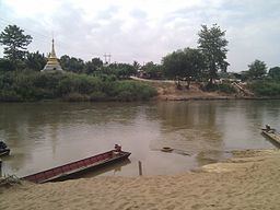
The Moei River (Thai: แม่น้ำเมย, rtgs: Maenam Moei, [mɛ̂ːnáːm mɤːj]) is a tributary of the Salween River. Unlike most rivers in Thailand, the Moei River flows north in a northwest direction. It originates in Phop Phra District, Tak Province, flowing then from south to north across Mae Sot, Mae Ramat, and Tha Song Yang Districts, finally entering the Salween River within the limits of Sop Moei District of Mae Hong Son Province. The river is 327 kilometres (203 mi) long.
Contents
Map of Moei
The Yuam River joins its left bank only 7 kilometres (4 mi) before its confluence with the Salween. Many fish species inhabit its waters, including the giant river catfish.
International borderEdit
The Moei River forms the border between Thailand and Burma.
The river is the scene of clashes between the Tatmadaw and Karen militias. Often Karen people cross the river either in order to enter Thailand as refugees or to go back to Burma.