
Municipality since 1822 Municipalities 8 Area 239.4 km² Population 173,442 (2012) | Distance to – Santo Domingo 145 km Climate Af Elevation 183 m | |
 | ||
Weather 22°C, Wind E at 8 km/h, 92% Humidity Neighborhoods Juan Lopito, La Estacion, Barrio Nueva Suiza | ||
Moca is the capital of Espaillat province, in the Cibao region of the Dominican Republic, and it is the tenth-largest city of that country. Moca is located 11 miles/18 kilometers away from the country’s second-largest city, Santiago. Known as "La Villa Heroica" (Village of Heroes) due to the amount of men and women from Moca who have played a major role in the Dominican Republic's history in bringing down two dictators, Ulises Heureaux and Rafael Trujillo, and bringing democracy back to the country.
Contents
Map of Moca 56000, Dominican Republic
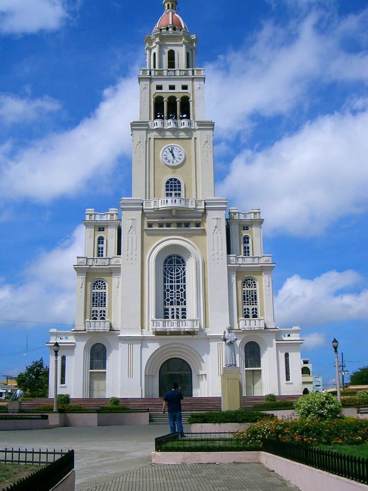
Moca is home to the Corazon Sagrado de Jesus ("Sacred Heart of Jesus") Cathedral. All its pane glass windows were originally brought from Italy depicting the apostles and Jesus' path to the crucifixion. Agriculture forms the primary livelihood of the inhabitants. Plantain and yucca are main crops. Most crops are harvested by hand.
Moca is also recognized for its strong political up bringing. Former dictator Rafael Trujillo owned a house in Moca. In fact, the house is located a few blocks from the church Sagrado Corazon De Jesus (picture above).
Etymology
According to Emiliano Tejera, Moca means a tree that overlooks the river banks. Others claim that the word comes from the region of Mocán, a section in the province of La Vega near the river. Others claim that the word Moca is based on the coffee crop name: Mocca. According to Franklin Torres Moca is derived from an Aboriginal term which was adopted by the European settlers.
Geography
Moca has a total area of 339.21 km². The municipality sits on a volcanic coral reef with hills to the west and low mountains to the north; these mountains are part of the Cordillera Septentrional. The highest mountain in the municipality, and in the province, is El Mogote at (970 m). Moca is at an elevation of 183 m with an average temperature in the city of 25.3°C and an average rainfall of 1,174.4 mm.
Economy
Moca has a very important banking sector, the city is home to branches of all commercial banks of the country. A strong business in shops, furniture, supermarkets, warehouses, factories of footwear, food, construction, and hardware. The city has the largest coffee manufacturing industry, Industries Banilejas.
The city is also known for its agricultural production, with the plantain, banana and cassava as major crops. Other fruits: bananas, pigeon pea, taro, yams, squash, beans, coffee, oranges, lemons, grapefruit, papaya (papaya), etc. A variety of vegetables such as lettuce, tomatoes, eggplants, peppers, cabbage are cultivated, among others. It also has a great development in poultry products, with a production of 70% in this sector.