
 | ||
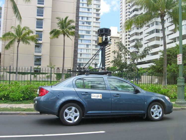
Mobile mapping is the process of collecting geospatial data from a mobile vehicle, typically fitted with a range of photographic, radar, laser, LiDAR or any number of remote sensing systems. Such systems are composed of an integrated array of time synchronised navigation sensors and imaging sensors mounted on a mobile platform. The primary output from such systems include GIS data, digital maps, and georeferenced images and video.
Contents
History
The development of direct reading georeferencing technologies opened the way for mobile mapping systems. GPS and Inertial Navigation Systems, have allowed rapid and accurate determination of position and attitude of remote sensing equipment, effectively leading to direct mapping of features of interest without the need for complex post-processing of observed data.
Aerial mobile mapping
Traditional techniques of geo-referencing aerial photography, ground profiling radar, or Lidar are prohibitively expensive, particularly in inaccessible areas, or where the type of data collected makes interpretation of individual features difficult. Image direct georeferencing, simplifies the mapping control for large scale mapping tasks.
Emergency response planning
Mobile mapping systems allow rapid collection of data to allow accurate assessment of conditions on the ground.
Internet applications
Internet, and mobile device users, are increasingly utilising geo-spatial information, either in the form of mapping, or geo-referenced imaging. Google, Microsoft, and Yahoo have adapted both aerial photographs and satellite images to develop online mapping systems. Street View type images are also an increasing market.
Location aware PDA systems rely on geo-referenced features collated from mobile mapping sources.
Road mapping and highway facility management
GPS combined with digital camera systems allow rapid update of road maps. The same system can be utilised to carry out efficient road condition surveys, and facilities management. Laser scanning technologies, applied in the mobile mapping sense, allow full 3D data collection of slope, bankings, etc.