 | ||
Into the moab fault
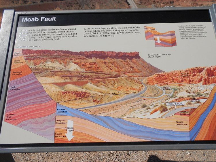
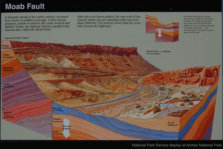
The Moab Fault, near Moab, Utah, United States, is a well exposed and much studied geological fault. The Moab fault is an extensional fault that runs approximately NW-SE, passing to the west of the Arches National Park. It is about 45 km (28 mi) long and has a maximum displacement of about 960 m (3,150 ft). The rocks on the SW side of the fault have been lifted up forming steep cliffs of Triassic Wingate sandstone and Chinle formation.
Contents
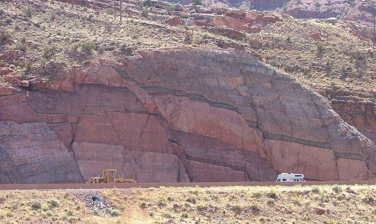
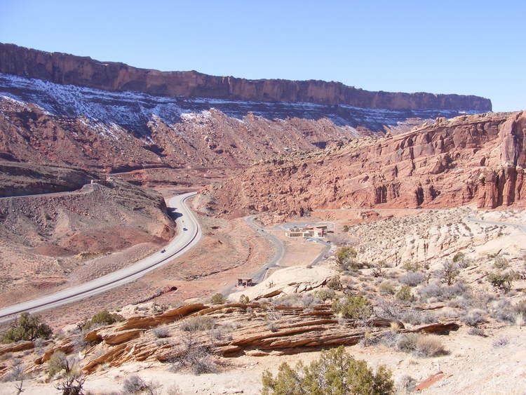
At the north end of the Moab valley, there is a fault transfer zone, where the fault steps east. This zone transfers the displacement along the fault from one segment to another. Within this zone there is very dense faulting. This is revealed in the road cutting for Highway 191 as seen in this picture taken from the nearby Arches National Park visitor centre.

Fault damage zones have great commercial interest to petroleum geoscientists as they can dramatically affect the performance of hydrocarbon reservoirs.
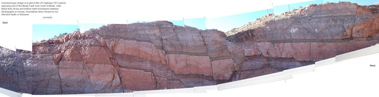
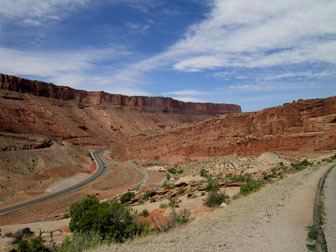
Panoramic view at moab fault overlook in arches national park